Wheatley night lights from space
Night Light of Wheatley (England) from space (United Kingdom) Src. Average luminocity for 10x10km area is 17.7605% and for 50x50km: 9.6269%.
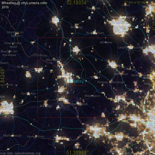
Analysis of Wheatley night lights 2016
Square area 10x10 km:
 4.06%
4.06%90-99
3.5%80-89
1.96%70-79
1.54%60-69
1.54%50-59
0.98%40-49
0.7%30-39
1.68%20-29
6.72%10-19
16.95%0-9
60.36%Square area 50x50 km:
1.27%90-99
1.78%80-89
0.91%70-79
0.84%60-69
0.93%50-59
0.99%40-49
1.44%30-39
1.04%20-29
2.99%10-19
8.44%0-9
79.35%Clear (daylight) street map image can be seen on geolist.org.
Map coordinates:
52° 10' 49.9" North, 1° 50' 33" West
51° 44' 50.3" North, 1° 8' 21.7" West
51° 18' 35.6" North, 0° 26' 10.5" West
Some cities around Wheatley sort by population:
• Oxford
8 km =5 mi,  273°
273°
• Abingdon
13 km =8.1 mi,  229°
229°
• Cowley
4.9 km =3 mi,  249°
249°
• Kidlington
13.2 km =8.2 mi,  308°
308°
• Thame
11.2 km =7 mi,  89°
89°
• Wallingford
16.4 km =10.2 mi,  176°
176°
• Benson
14.2 km =8.8 mi,  171°
171°
• Chinnor
16.5 km =10.3 mi,  107°
107°
2634171 (p: 5,574)
Sources (retrieved 2019-11-25):
» Earth at Night: Flat Maps 2012, 2016