Abingdon night lights from space
Night Light of Abingdon (England) from space (United Kingdom) Src. Average luminocity for 10x10km area is 29.1667% and for 50x50km: 9.0958%.
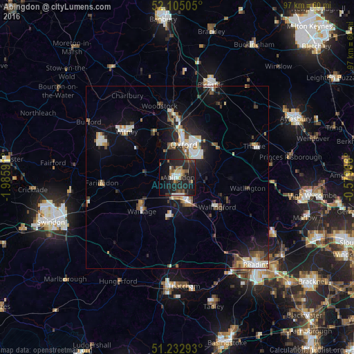
Analysis of Abingdon night lights 2016
Square area 10x10 km:
 2.66%
2.66%90-99
4.06%80-89
2.94%70-79
1.96%60-69
2.66%50-59
4.76%40-49
4.9%30-39
3.22%20-29
23.67%10-19
32.77%0-9
16.39%Square area 50x50 km:
1.21%90-99
1.89%80-89
0.69%70-79
0.67%60-69
0.99%50-59
0.81%40-49
1.61%30-39
1.07%20-29
3.15%10-19
7.02%0-9
80.88%Clear (daylight) street map image can be seen on geolist.org.
Map coordinates:
52° 6' 18.2" North, 1° 59' 9.3" West
51° 40' 15.9" North, 1° 16' 58" West
51° 13' 58.5" North, 0° 34' 46.8" West
Some cities around Abingdon sort by population:
• Oxford
9.2 km =5.7 mi,  11°
11°
• Didcot
7.4 km =4.6 mi,  157°
157°
• Wantage
13.5 km =8.4 mi,  227°
227°
• Grove
11.8 km =7.3 mi, 234°
• Cowley
8.6 km =5.3 mi,  37°
37°
• Wallingford
13.5 km =8.4 mi,  126°
126°
• Benson
13.2 km =8.2 mi,  115°
115°
• Wheatley
13 km =8.1 mi,  49°
49°
2657780 (p: 38,676)
Sources (retrieved 2019-11-25):
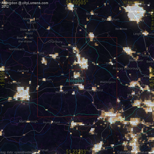
» Earth at Night: Flat Maps 2012, 2016