Milford night lights from space
Night Light of Milford (England) from space (United Kingdom) Src. Average luminocity for 10x10km area is 5.9505% and for 50x50km: 12.6634%.
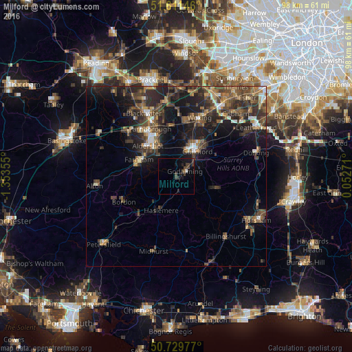
Analysis of Milford night lights 2016
Square area 10x10 km:
 0.13%
0.13%90-99
0.4%80-89
0%70-79
0%60-69
0.13%50-59
0.4%40-49
2.94%30-39
3.74%20-29
1.47%10-19
5.61%0-9
85.16%Square area 50x50 km:
0.93%90-99
1.22%80-89
0.79%70-79
1.24%60-69
1.84%50-59
2.68%40-49
3.91%30-39
3.84%20-29
4.88%10-19
9.32%0-9
69.36%Clear (daylight) street map image can be seen on geolist.org.
Map coordinates:
51° 36' 41.3" North, 1° 21' 12.8" West
51° 10' 21.8" North, 0° 39' 1.5" West
50° 43' 47.2" North, 0° 3' 9.8" East
Some cities around Milford sort by population:
• Guildford
8.8 km =5.5 mi,  37°
37°
• Aldershot
11.5 km =7.1 mi,  316°
316°
• Farnham
11.4 km =7.1 mi,  293°
293°
• Godalming
2.9 km =1.8 mi,  59°
59°
• Hale
11.5 km =7.1 mi,  303°
303°
• Haslemere
10 km =6.2 mi,  203°
203°
• Witley
2.5 km =1.6 mi,  175°
175°
• Hindhead
8.7 km =5.4 mi,  221°
221°
2642537 (p: 6,220)
Sources (retrieved 2019-11-25):
» Earth at Night: Flat Maps 2012, 2016