Aldershot night lights from space
Night Light of Aldershot (England) from space (United Kingdom) Src. Average luminocity for 10x10km area is 38.7241% and for 50x50km: 18.9918%.
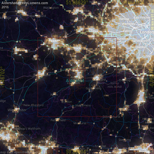

Analysis of Aldershot night lights 2016
Square area 10x10 km:
 4.76%
4.76%90-99
7.42%80-89
3.08%70-79
4.9%60-69
4.48%50-59
4.06%40-49
9.66%30-39
9.52%20-29
13.17%10-19
28.99%0-9
9.94%Square area 50x50 km:
2.25%90-99
2.66%80-89
1.3%70-79
2.3%60-69
2.79%50-59
3.71%40-49
4.5%30-39
4.04%20-29
6.55%10-19
12.69%0-9
57.2%Clear (daylight) street map image can be seen on geolist.org.
Map coordinates:
51° 41' 10.6" North, 1° 28' 1.3" West
51° 14' 53.8" North, 0° 45' 50" West
50° 48' 21.7" North, 0° 3' 38.8" West
Some cities around Aldershot sort by population:
• Farnborough
5.1 km =3.2 mi,  6°
6°
• Fleet
6.2 km =3.9 mi,  308°
308°
• Farnham
4.5 km =2.8 mi,  214°
214°
• Camberley
10 km =6.2 mi, 8°
• Yateley
11.5 km =7.1 mi,  336°
336°
• Hale
2.7 km =1.7 mi,  219°
219°
• Frimley
7.7 km =4.8 mi, 9°
• Milford
11.5 km =7.1 mi,  136°
136°
2657540 (p: 61,339)
Sources (retrieved 2019-11-25):
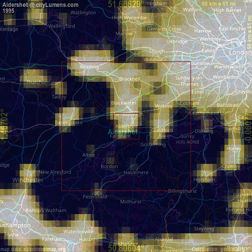
» NASA, Earths city lights 1995
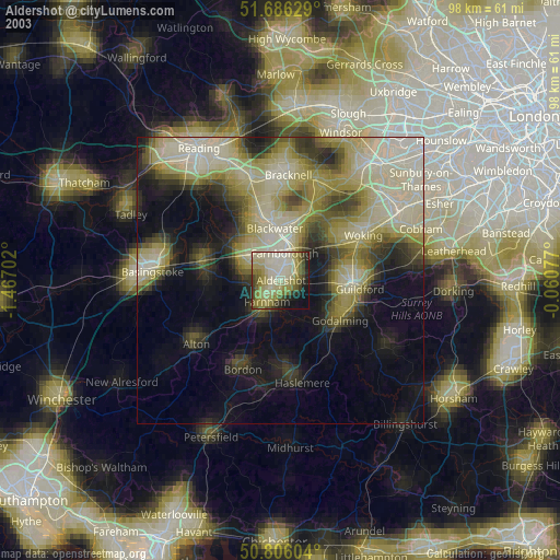
» NASA city lights 2003
» Earth at Night: Flat Maps 2012, 2016