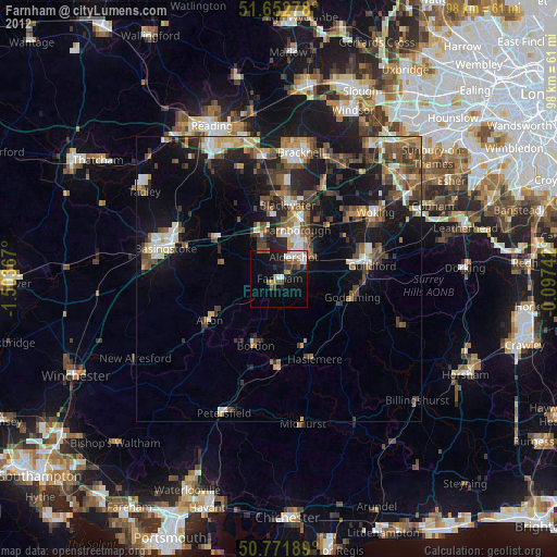
Farnham night lights from space
Night Light of Farnham (England) from space (United Kingdom) Src. Average luminocity for 10x10km area is 20.3403% and for 50x50km: 15.1662%.
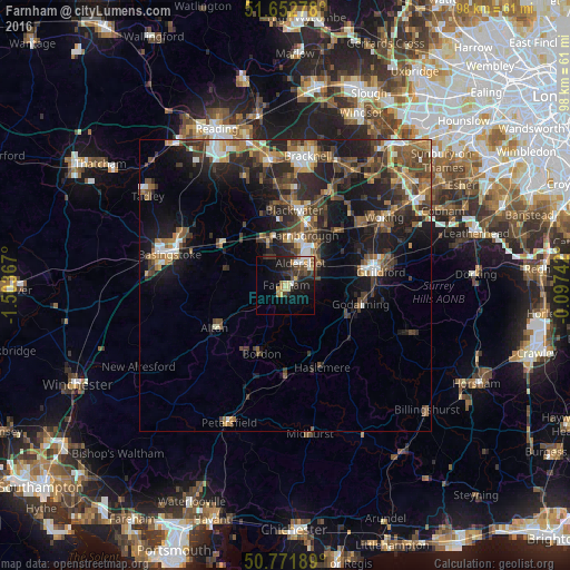
Analysis of Farnham night lights 2016
Square area 10x10 km:
100  1.68%
1.68%
90-99 2.66%
80-89 2.94%
70-79 2.8%
60-69 1.68%
50-59 1.4%
40-49 3.5%
30-39 6.02%
20-29 7.28%
10-19 17.09%
0-9 52.94%
1.68%90-99
2.66%80-89
2.94%70-79
2.8%60-69
1.68%50-59
1.4%40-49
3.5%30-39
6.02%20-29
7.28%10-19
17.09%0-9
52.94%Square area 50x50 km:
100 1.41%
90-99 1.79%
80-89 0.95%
70-79 1.88%
60-69 2.5%
50-59 2.9%
40-49 3.89%
30-39 3.66%
20-29 5.48%
10-19 10.75%
0-9 64.8%
1.41%90-99
1.79%80-89
0.95%70-79
1.88%60-69
2.5%50-59
2.9%40-49
3.89%30-39
3.66%20-29
5.48%10-19
10.75%0-9
64.8%Clear (daylight) street map image can be seen on geolist.org.
Map coordinates:
51° 39' 10" North, 1° 30' 13.2" West
51° 12' 52" North, 0° 48' 1.9" West
50° 46' 18.8" North, 0° 5' 50.7" West
Some cities around Farnham sort by population:
• Aldershot
4.5 km =2.8 mi,  34°
34°
• Farnborough
9.4 km =5.8 mi,  19°
19°
• Fleet
8 km =5 mi,  343°
343°
• Bordon
12 km =7.5 mi,  201°
201°
• Hale
1.9 km =1.2 mi, 25°
• Frimley
12 km =7.5 mi, 18°
• Milford
11.4 km =7.1 mi,  113°
113°
• Hindhead
12.1 km =7.5 mi,  157°
157°
2649660 (p: 36,971)
Sources (retrieved 2019-11-25):
» Earth at Night: Flat Maps 2012, 2016