Hale night lights from space
Night Light of Hale (England) from space (United Kingdom) Src. Average luminocity for 10x10km area is 27.8361% and for 50x50km: 16.5676%.
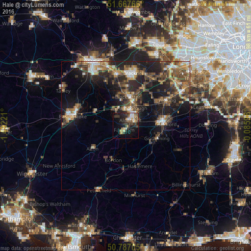
Analysis of Hale night lights 2016
Square area 10x10 km:
 3.08%
3.08%90-99
3.78%80-89
2.94%70-79
3.08%60-69
2.66%50-59
3.5%40-49
5.32%30-39
9.38%20-29
10.08%10-19
21.01%0-9
35.15%Square area 50x50 km:
1.65%90-99
2.06%80-89
1.1%70-79
1.96%60-69
2.72%50-59
3.27%40-49
4.11%30-39
3.87%20-29
6.01%10-19
11.45%0-9
61.81%Clear (daylight) street map image can be seen on geolist.org.
Map coordinates:
51° 40' 3.6" North, 1° 29' 32" West
51° 13' 46.1" North, 0° 47' 20.7" West
50° 47' 13.4" North, 0° 5' 9.5" West
Some cities around Hale sort by population:
• Aldershot
2.7 km =1.7 mi,  39°
39°
• Farnborough
7.6 km =4.7 mi,  17°
17°
• Fleet
6.7 km =4.2 mi,  332°
332°
• Farnham
1.9 km =1.2 mi,  205°
205°
• Camberley
12.4 km =7.7 mi, 15°
• Yateley
12.9 km =8 mi,  347°
347°
• Frimley
10.2 km =6.3 mi, 17°
• Milford
11.5 km =7.1 mi,  123°
123°
2647644 (p: 15,657)
Sources (retrieved 2019-11-25):
» Earth at Night: Flat Maps 2012, 2016