Guildford night lights from space
Night Light of Guildford (England) from space (United Kingdom) Src. Average luminocity for 10x10km area is 24.5882% and for 50x50km: 22.8403%.
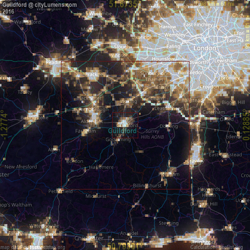
Analysis of Guildford night lights 2016
Square area 10x10 km:
 3.5%
3.5%90-99
3.22%80-89
0.56%70-79
1.96%60-69
1.96%50-59
5.04%40-49
4.2%30-39
7%20-29
5.46%10-19
31.65%0-9
35.43%Square area 50x50 km:
2.7%90-99
3.51%80-89
1.68%70-79
2.81%60-69
3.92%50-59
4.54%40-49
5.36%30-39
4.69%20-29
6.97%10-19
12.3%0-9
51.52%Clear (daylight) street map image can be seen on geolist.org.
Map coordinates:
51° 40' 24.6" North, 1° 16' 38.6" West
51° 14' 7.3" North, 0° 34' 27.4" West
50° 47' 34.8" North, 0° 7' 43.9" East
Some cities around Guildford sort by population:
• Woking
9.4 km =5.8 mi,  6°
6°
• Godalming
6.2 km =3.9 mi,  207°
207°
• Knaphill
9.9 km =6.2 mi,  342°
342°
• Send
6.8 km =4.2 mi,  29°
29°
• Witley
10.8 km =6.7 mi, 208°
• Milford
8.8 km =5.5 mi,  217°
217°
• East Horsley
10.8 km =6.7 mi,  66°
66°
• West Clandon
5.7 km =3.5 mi,  60°
60°
2647793 (p: 71,873)
Sources (retrieved 2019-11-25):
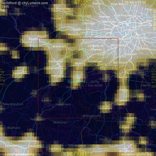
» NASA, Earths city lights 1995
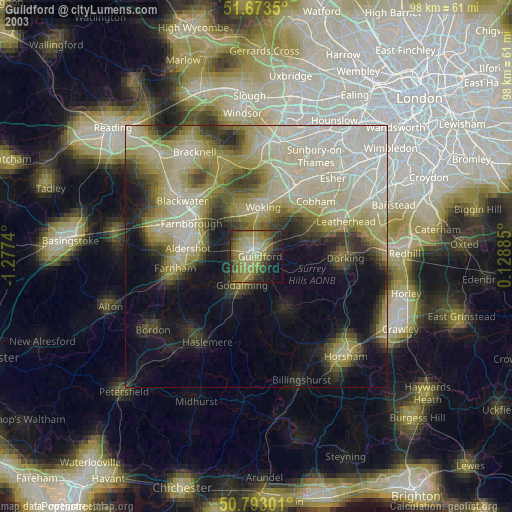
» NASA city lights 2003
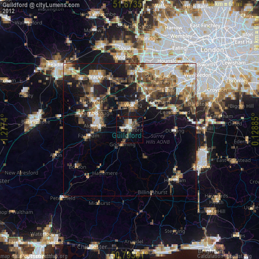
» Earth at Night: Flat Maps 2012, 2016