Spalding night lights from space
Night Light of Spalding (England) from space (United Kingdom) Src. Average luminocity for 10x10km area is 14.6919% and for 50x50km: 5.8803%.
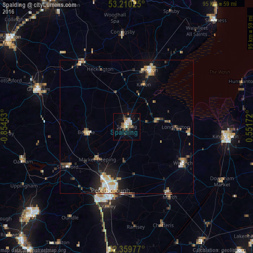
Analysis of Spalding night lights 2016
Square area 10x10 km:
 3.28%
3.28%90-99
1.77%80-89
0.51%70-79
1.01%60-69
1.52%50-59
2.78%40-49
2.78%30-39
1.89%20-29
2.53%10-19
7.45%0-9
74.49%Square area 50x50 km:
0.79%90-99
0.88%80-89
0.57%70-79
0.73%60-69
0.86%50-59
0.88%40-49
0.81%30-39
0.67%20-29
1.38%10-19
3.02%0-9
89.42%Clear (daylight) street map image can be seen on geolist.org.
Map coordinates:
53° 12' 36.9" North, 0° 51' 16.3" West
52° 47' 13.5" North, 0° 9' 5.1" West
52° 21' 35.2" North, 0° 33' 6.2" East
Some cities around Spalding sort by population:
• Peterborough
24.6 km =15.3 mi,  195°
195°
• Boston
22.6 km =14 mi,  21°
21°
• Wisbech
24.9 km =15.5 mi,  122°
122°
• Stamford
27.1 km =16.8 mi,  235°
235°
• Bourne
15.8 km =9.8 mi,  261°
261°
• Market Deeping
16.6 km =10.3 mi,  222°
222°
• Whittlesey
25.5 km =15.8 mi,  176°
176°
• Holbeach
11.3 km =7 mi,  80°
80°
2637265 (p: 31,588)
Sources (retrieved 2019-11-25):
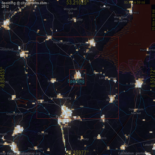
» Earth at Night: Flat Maps 2012, 2016