Holbeach night lights from space
Night Light of Holbeach (England) from space (United Kingdom) Src. Average luminocity for 10x10km area is 5.6035% and for 50x50km: 4.8385%.
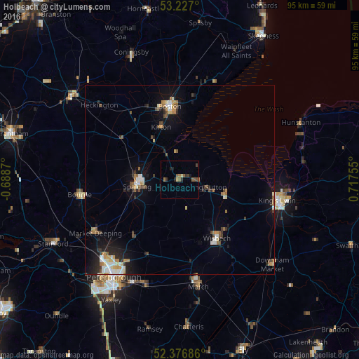
Analysis of Holbeach night lights 2016
Square area 10x10 km:
 0%
0%90-99
0.25%80-89
0.76%70-79
0.38%60-69
0.88%50-59
2.53%40-49
1.01%30-39
1.39%20-29
1.64%10-19
1.01%0-9
90.15%Square area 50x50 km:
0.64%90-99
0.7%80-89
0.41%70-79
0.56%60-69
0.67%50-59
0.69%40-49
0.53%30-39
0.61%20-29
1.14%10-19
3.1%0-9
90.95%Clear (daylight) street map image can be seen on geolist.org.
Map coordinates:
53° 13' 37.2" North, 0° 41' 19.3" West
52° 48' 14.4" North, 0° 0' 51.9" East
52° 22' 36.7" North, 0° 43' 3.2" East
Some cities around Holbeach sort by population:
• King's Lynn
26.3 km =16.3 mi,  102°
102°
• Boston
19.4 km =12.1 mi,  351°
351°
• Wisbech
18.2 km =11.3 mi,  147°
147°
• Spalding
11.3 km =7 mi,  260°
260°
• March
28.5 km =17.7 mi,  169°
169°
• Bourne
27.1 km =16.8 mi, 261°
• Market Deeping
26.4 km =16.4 mi,  237°
237°
• Whittlesey
29 km =18 mi,  199°
199°
2646787 (p: 7,914)
Sources (retrieved 2019-11-25):
» Earth at Night: Flat Maps 2012, 2016