Little Lever night lights from space
Night Light of Little Lever (England) from space (United Kingdom) Src. Average luminocity for 10x10km area is 76.1515% and for 50x50km: 50.5612%.
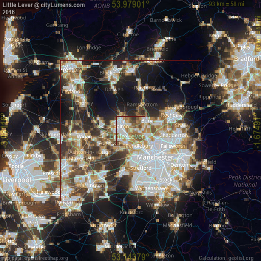
Analysis of Little Lever night lights 2016
Square area 10x10 km:
 17.17%
90-99
17.93%80-89
12.12%70-79
11.36%60-69
18.18%50-59
12.88%40-49
7.07%30-39
2.27%20-29
1.01%10-19
0%0-9
0%Square area 50x50 km:
13.28%90-99
11.54%80-89
5.03%70-79
5.67%60-69
6.48%50-59
6.07%40-49
6.64%30-39
6.55%20-29
10.2%10-19
13.55%0-9
15.01%Clear (daylight) street map image can be seen on geolist.org.
Map coordinates:
53° 58' 44.4" North, 3° 4' 52.2" West
53° 33' 48.5" North, 2° 22' 40.9" West
53° 8' 37.6" North, 1° 40' 29.7" West
Some cities around Little Lever sort by population:
• Bolton
4.3 km =2.7 mi,  301°
301°
• Bury
6.6 km =4.1 mi,  51°
51°
• Walkden
5.4 km =3.4 mi,  195°
195°
• Radcliffe
3.5 km =2.2 mi,  93°
93°
• Farnworth
2.1 km =1.3 mi,  224°
224°
• Whitefield
5.4 km =3.4 mi,  106°
106°
• Kearsley
3.4 km =2.1 mi,  185°
185°
• Tottington
6.1 km =3.8 mi,  23°
23°
2644299 (p: 11,329)
Sources (retrieved 2019-11-25):
» Earth at Night: Flat Maps 2012, 2016