Knaphill night lights from space
Night Light of Knaphill (England) from space (United Kingdom) Src. Average luminocity for 10x10km area is 24.3361% and for 50x50km: 32.0387%.
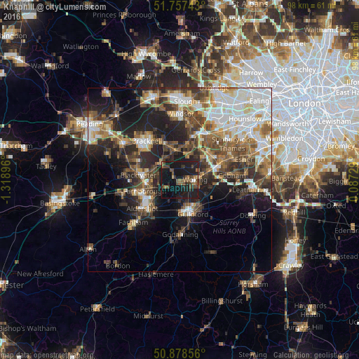
Analysis of Knaphill night lights 2016
Square area 10x10 km:
 0.7%
0.7%90-99
0.42%80-89
1.12%70-79
1.26%60-69
3.5%50-59
8.54%40-49
6.86%30-39
3.92%20-29
8.82%10-19
52.24%0-9
12.61%Square area 50x50 km:
6.13%90-99
6.56%80-89
2.73%70-79
3.47%60-69
4.21%50-59
5.16%40-49
6%30-39
5.32%20-29
7.98%10-19
13.57%0-9
38.88%Clear (daylight) street map image can be seen on geolist.org.
Map coordinates:
51° 45' 26.7" North, 1° 19' 8.3" West
51° 19' 12.4" North, 0° 36' 57" West
50° 52' 42.8" North, 0° 5' 14.2" East
Some cities around Knaphill sort by population:
• Woking
4 km =2.5 mi,  91°
91°
• Guildford
9.9 km =6.2 mi,  162°
162°
• Camberley
9 km =5.6 mi,  282°
282°
• Frimley
9 km =5.6 mi,  267°
267°
• Lightwater
5 km =3.1 mi,  309°
309°
• Send
7.1 km =4.4 mi,  119°
119°
• Bagshot
6.7 km =4.2 mi, 311°
• West Byfleet
7.8 km =4.8 mi,  75°
75°
6693245 (p: 8,635)
Sources (retrieved 2019-11-25):
» Earth at Night: Flat Maps 2012, 2016