Ingatestone night lights from space
Night Light of Ingatestone (England) from space (United Kingdom) Src. Average luminocity for 10x10km area is 11.5686% and for 50x50km: 30.8482%.
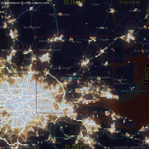
Analysis of Ingatestone night lights 2016
Square area 10x10 km:
 0.28%
0.28%90-99
0%80-89
1.26%70-79
0.42%60-69
0.56%50-59
3.78%40-49
4.76%30-39
1.82%20-29
2.24%10-19
8.12%0-9
76.75%Square area 50x50 km:
7.46%90-99
6.81%80-89
3.01%70-79
2.85%60-69
3.06%50-59
3.48%40-49
4.11%30-39
4.13%20-29
7.75%10-19
14.46%0-9
42.89%Clear (daylight) street map image can be seen on geolist.org.
Map coordinates:
52° 6' 15.3" North, 0° 19' 10.3" West
51° 40' 13" North, 0° 23' 0.9" East
51° 13' 55.6" North, 1° 5' 12.2" East
Some cities around Ingatestone sort by population:
• Basildon
12.4 km =7.7 mi,  155°
155°
• Chelmsford
9.4 km =5.8 mi,  39°
39°
• Brentwood
7.7 km =4.8 mi,  224°
224°
• Billericay
5.3 km =3.3 mi,  151°
151°
• Wickford
11.7 km =7.3 mi,  124°
124°
• Harold Wood
13.4 km =8.3 mi,  231°
231°
• Danbury
14.6 km =9.1 mi,  69°
69°
• Chipping Ongar
10.2 km =6.3 mi,  291°
291°
2646219 (p: 5,620)
Sources (retrieved 2019-11-25):
» Earth at Night: Flat Maps 2012, 2016