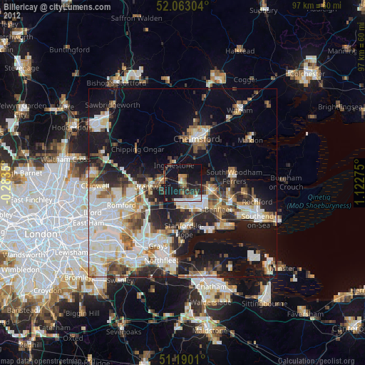
Billericay night lights from space
Night Light of Billericay (England) from space (United Kingdom) Src. Average luminocity for 10x10km area is 22.7286% and for 50x50km: 32.0181%.
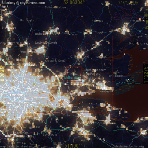
Analysis of Billericay night lights 2016
Square area 10x10 km:
 2.14%
2.14%90-99
2.81%80-89
1.87%70-79
1.74%60-69
1.6%50-59
3.21%40-49
3.34%30-39
6.02%20-29
10.7%10-19
30.08%0-9
36.5%Square area 50x50 km:
6.74%90-99
6.99%80-89
3.58%70-79
3.52%60-69
3.4%50-59
3.77%40-49
4.12%30-39
4.26%20-29
8.65%10-19
15.27%0-9
39.69%Clear (daylight) street map image can be seen on geolist.org.
Map coordinates:
52° 3' 46.9" North, 0° 17' 0.6" West
51° 37' 43.2" North, 0° 25' 10.7" East
51° 11' 24.4" North, 1° 7' 21.9" East
Some cities around Billericay sort by population:
• Basildon
7.2 km =4.5 mi,  158°
158°
• Chelmsford
12.4 km =7.7 mi,  16°
16°
• Brentwood
7.9 km =4.9 mi,  264°
264°
• South Benfleet
12.8 km =8 mi,  131°
131°
• Wickford
7.4 km =4.6 mi,  105°
105°
• Stanford-le-Hope
11.8 km =7.3 mi,  175°
175°
• Pitsea
9.5 km =5.9 mi,  139°
139°
• Ingatestone
5.3 km =3.3 mi,  331°
331°
2655672 (p: 36,338)
Sources (retrieved 2019-11-25):
» Earth at Night: Flat Maps 2012, 2016