Brentwood night lights from space
Night Light of Brentwood (England) from space (United Kingdom) Src. Average luminocity for 10x10km area is 34.7045% and for 50x50km: 40.929%.
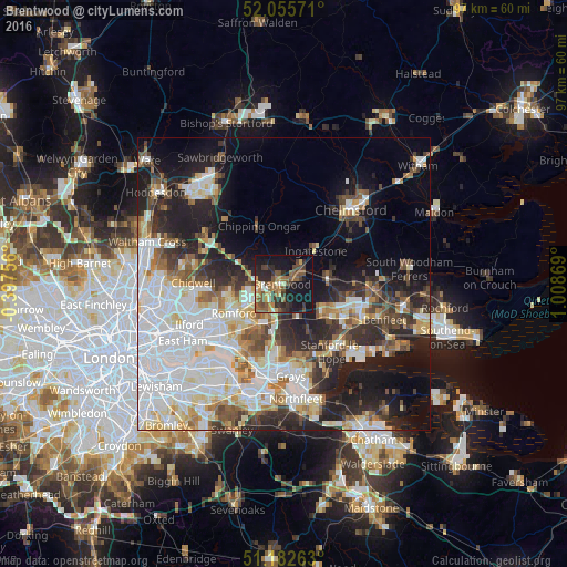
Analysis of Brentwood night lights 2016
Square area 10x10 km:
 1.6%
1.6%90-99
2.94%80-89
3.88%70-79
4.41%60-69
6.95%50-59
10.16%40-49
7.75%30-39
6.02%20-29
13.37%10-19
31.68%0-9
11.23%Square area 50x50 km:
12.42%90-99
8.99%80-89
4.38%70-79
3.53%60-69
3.85%50-59
4.21%40-49
4.5%30-39
4.74%20-29
9.07%10-19
13.55%0-9
30.77%Clear (daylight) street map image can be seen on geolist.org.
Map coordinates:
52° 3' 20.6" North, 0° 23' 51.2" West
51° 37' 16.6" North, 0° 18' 20" East
51° 10' 57.5" North, 1° 0' 31.3" East
Some cities around Brentwood sort by population:
• Romford
9.7 km =6 mi,  238°
238°
• Billericay
7.9 km =4.9 mi,  84°
84°
• Hornchurch
9.4 km =5.8 mi,  220°
220°
• Harold Wood
5.8 km =3.6 mi, 239°
• Collier Row
10 km =6.2 mi,  255°
255°
• Upminster
8 km =5 mi,  205°
205°
• Chipping Ongar
10.1 km =6.3 mi,  335°
335°
• Ingatestone
7.7 km =4.8 mi,  44°
44°
2654782 (p: 52,586)
Sources (retrieved 2019-11-25):
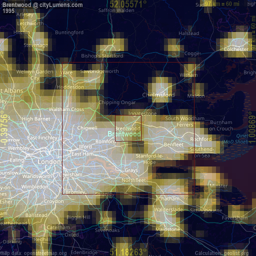
» NASA, Earths city lights 1995
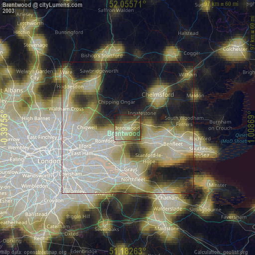
» NASA city lights 2003
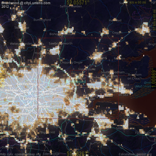
» Earth at Night: Flat Maps 2012, 2016