Harold Wood night lights from space
Night Light of Harold Wood (England) from space (United Kingdom) Src. Average luminocity for 10x10km area is 67.5281% and for 50x50km: 49.0088%.
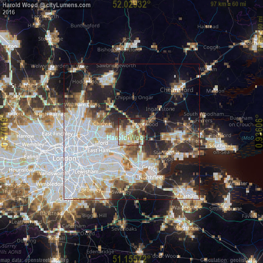
Analysis of Harold Wood night lights 2016
Square area 10x10 km:
 10.83%
90-99
13.77%80-89
16.84%70-79
10.56%60-69
11.23%50-59
10.7%40-49
5.88%30-39
8.29%20-29
11.9%10-19
0%0-9
0%Square area 50x50 km:
17.94%90-99
10.86%80-89
4.89%70-79
3.85%60-69
4.21%50-59
4.27%40-49
4.56%30-39
4.73%20-29
9.09%10-19
14.24%0-9
21.37%Clear (daylight) street map image can be seen on geolist.org.
Map coordinates:
52° 1' 45.6" North, 0° 28' 12.7" West
51° 35' 40.6" North, 0° 13' 58.6" East
51° 9' 20.6" North, 0° 56' 9.8" East
Some cities around Harold Wood sort by population:
• Dagenham
6.8 km =4.2 mi,  222°
222°
• Romford
3.9 km =2.4 mi,  236°
236°
• Brentwood
5.8 km =3.6 mi,  59°
59°
• Hornchurch
4.3 km =2.7 mi,  195°
195°
• Elm Park
5.5 km =3.4 mi, 203°
• Collier Row
4.6 km =2.9 mi,  275°
275°
• Upminster
4.6 km =2.9 mi,  159°
159°
• Chadwell Heath
7.4 km =4.6 mi,  249°
249°
6690868 (p: 12,443)
Sources (retrieved 2019-11-25):
» Earth at Night: Flat Maps 2012, 2016