Fleet night lights from space
Night Light of Fleet (England) from space (United Kingdom) Src. Average luminocity for 10x10km area is 24.6947% and for 50x50km: 19.4874%.
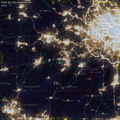
Analysis of Fleet night lights 2016
Square area 10x10 km:
100  2.1%
2.1%
90-99 2.66%
80-89 1.12%
70-79 1.4%
60-69 4.34%
50-59 2.66%
40-49 8.96%
30-39 7.56%
20-29 13.73%
10-19 18.63%
0-9 36.83%
2.1%90-99
2.66%80-89
1.12%70-79
1.4%60-69
4.34%50-59
2.66%40-49
8.96%30-39
7.56%20-29
13.73%10-19
18.63%0-9
36.83%Square area 50x50 km:
100 2.04%
90-99 2.6%
80-89 1.4%
70-79 2.27%
60-69 2.81%
50-59 3.66%
40-49 4.79%
30-39 4.21%
20-29 7.24%
10-19 14.11%
0-9 54.87%
2.04%90-99
2.6%80-89
1.4%70-79
2.27%60-69
2.81%50-59
3.66%40-49
4.79%30-39
4.21%20-29
7.24%10-19
14.11%0-9
54.87%Clear (daylight) street map image can be seen on geolist.org.
Map coordinates:
51° 43' 15.6" North, 1° 32' 11.2" West
51° 16' 60" North, 0° 49' 60" West
50° 50' 29.2" North, 0° 7' 48.7" West
Some cities around Fleet sort by population:
• Aldershot
6.2 km =3.9 mi,  128°
128°
• Farnborough
5.5 km =3.4 mi,  77°
77°
• Farnham
8 km =5 mi,  163°
163°
• Camberley
8.7 km =5.4 mi,  46°
46°
• Yateley
6.6 km =4.1 mi,  2°
2°
• Hale
6.7 km =4.2 mi,  152°
152°
• Frimley
7.1 km =4.4 mi,  58°
58°
• Hook
8.8 km =5.5 mi,  270°
270°
2649322 (p: 38,726)
Sources (retrieved 2019-11-25):
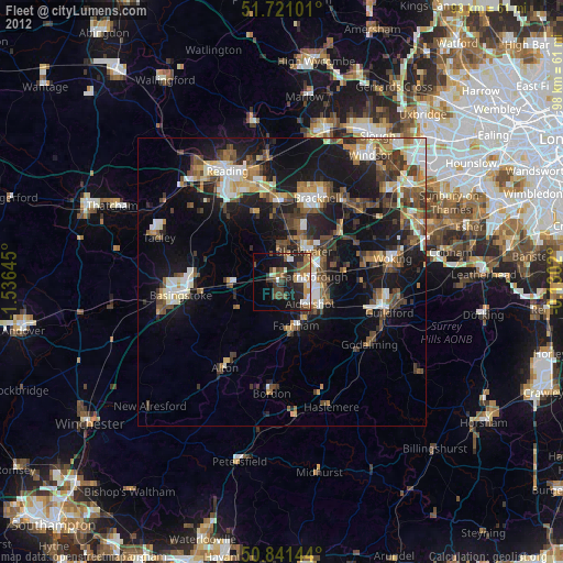
» Earth at Night: Flat Maps 2012, 2016