Farnborough night lights from space
Night Light of Farnborough (England) from space (United Kingdom) Src. Average luminocity for 10x10km area is 45.3193% and for 50x50km: 23.7159%.
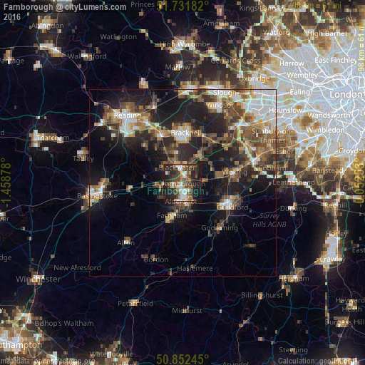
Analysis of Farnborough night lights 2016
Square area 10x10 km:
 6.44%
6.44%90-99
8.96%80-89
0.56%70-79
5.32%60-69
6.3%50-59
6.02%40-49
17.37%30-39
10.5%20-29
16.67%10-19
21.01%0-9
0.84%Square area 50x50 km:
3.44%90-99
3.81%80-89
1.74%70-79
2.71%60-69
3.16%50-59
4.38%40-49
5.29%30-39
4.49%20-29
7.58%10-19
14.69%0-9
48.69%Clear (daylight) street map image can be seen on geolist.org.
Map coordinates:
51° 43' 54.6" North, 1° 27' 31.6" West
51° 17' 39.3" North, 0° 45' 20.3" West
50° 51' 8.8" North, 0° 3' 9.1" West
Some cities around Farnborough sort by population:
• Aldershot
5.1 km =3.2 mi,  186°
186°
• Fleet
5.5 km =3.4 mi,  257°
257°
• Camberley
4.8 km =3 mi,  10°
10°
• Yateley
7.5 km =4.7 mi,  316°
316°
• Hale
7.6 km =4.7 mi,  197°
197°
• Frimley
2.6 km =1.6 mi,  15°
15°
• Lightwater
8.4 km =5.2 mi,  44°
44°
• Bagshot
8.8 km =5.5 mi,  32°
32°
2649672 (p: 59,902)
Sources (retrieved 2019-11-25):
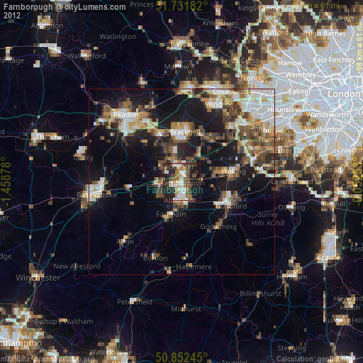
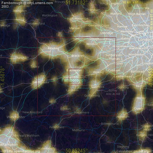
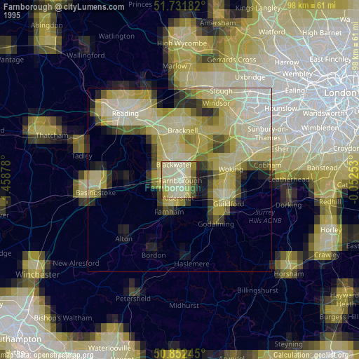
» NASA, Earths city lights 1995
» NASA city lights 2003
» Earth at Night: Flat Maps 2012, 2016