Cinderford night lights from space
Night Light of Cinderford (England) from space (United Kingdom) Src. Average luminocity for 10x10km area is 2.8417% and for 50x50km: 4.7825%.
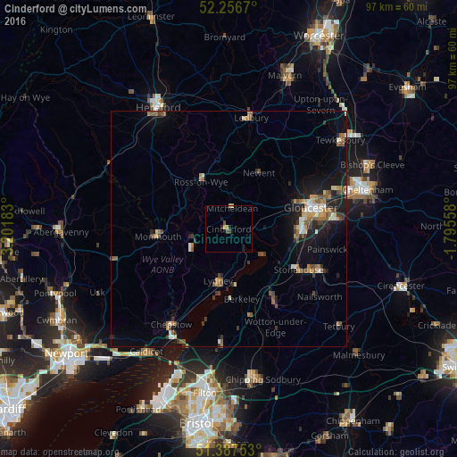
Analysis of Cinderford night lights 2016
Square area 10x10 km:
 0%
0%90-99
0%80-89
0.56%70-79
1.12%60-69
0%50-59
0%40-49
1.54%30-39
0.14%20-29
1.26%10-19
0.42%0-9
94.96%Square area 50x50 km:
0.34%90-99
0.53%80-89
0.48%70-79
0.61%60-69
0.74%50-59
0.94%40-49
0.73%30-39
0.68%20-29
1.13%10-19
3.54%0-9
90.27%Clear (daylight) street map image can be seen on geolist.org.
Map coordinates:
52° 15' 24.1" North, 3° 12' 6.6" West
51° 49' 27.2" North, 2° 29' 55.3" West
51° 23' 15.1" North, 1° 47' 44.1" West
Some cities around Cinderford sort by population:
• Gloucester
18.2 km =11.3 mi,  75°
75°
• Stroud
22.1 km =13.7 mi,  111°
111°
• Dursley
18.8 km =11.7 mi,  147°
147°
• Ross on Wye
11.3 km =7 mi,  335°
335°
• Coleford
8.5 km =5.3 mi,  247°
247°
• Monmouth
14.8 km =9.2 mi,  265°
265°
• Lydney
11.1 km =6.9 mi,  189°
189°
• Stonehouse
17 km =10.6 mi,  119°
119°
2652997 (p: 12,942)
Sources (retrieved 2019-11-25):
» Earth at Night: Flat Maps 2012, 2016