Lydney night lights from space
Night Light of Lydney (England) from space (United Kingdom) Src. Average luminocity for 10x10km area is 5.9174% and for 50x50km: 8.2816%.
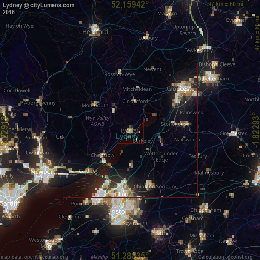
Analysis of Lydney night lights 2016
Square area 10x10 km:
 0%
0%90-99
0.84%80-89
0.28%70-79
0.98%60-69
0.98%50-59
1.68%40-49
1.4%30-39
1.54%20-29
1.26%10-19
0.56%0-9
90.48%Square area 50x50 km:
1.1%90-99
1.39%80-89
0.68%70-79
1.07%60-69
1%50-59
1.27%40-49
0.97%30-39
1.1%20-29
2.38%10-19
5.96%0-9
83.06%Clear (daylight) street map image can be seen on geolist.org.
Map coordinates:
52° 9' 33.9" North, 3° 13' 45" West
51° 43' 33.5" North, 2° 31' 33.8" West
51° 17' 18.1" North, 1° 49' 22.5" West
Some cities around Lydney sort by population:
• Chepstow
14.1 km =8.8 mi,  227°
227°
• Dursley
12.9 km =8 mi,  112°
112°
• Cinderford
11.1 km =6.9 mi,  9°
9°
• Thornbury
13 km =8.1 mi,  178°
178°
• Coleford
9.8 km =6.1 mi,  322°
322°
• Monmouth
16.1 km =10 mi,  306°
306°
• Stonehouse
16.9 km =10.5 mi,  80°
80°
• Wotton-under-Edge
16.2 km =10.1 mi,  129°
129°
2643318 (p: 8,776)
Sources (retrieved 2019-11-25):
» Earth at Night: Flat Maps 2012, 2016