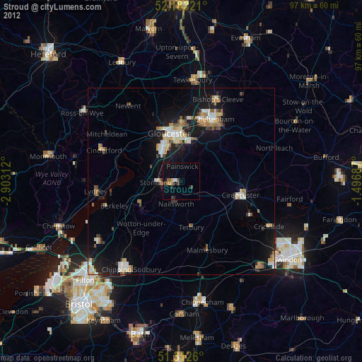
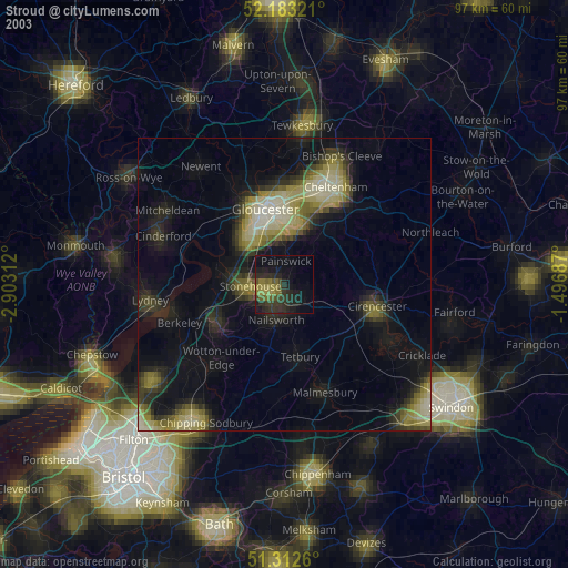
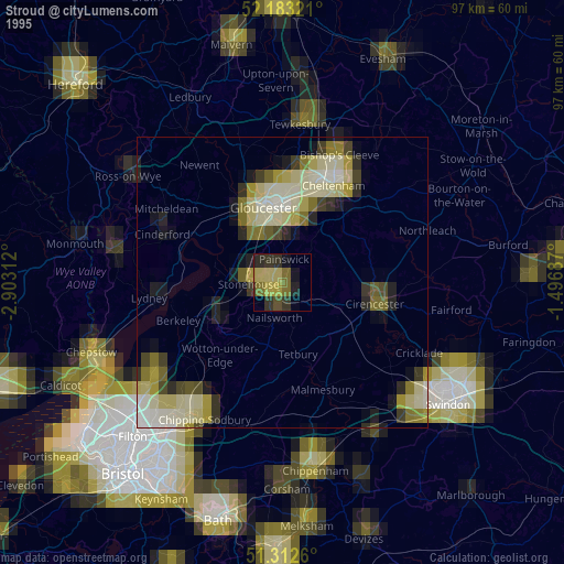
Stroud night lights from space
Night Light of Stroud (England) from space (United Kingdom) Src. Average luminocity for 10x10km area is 8.1162% and for 50x50km: 6.7364%.
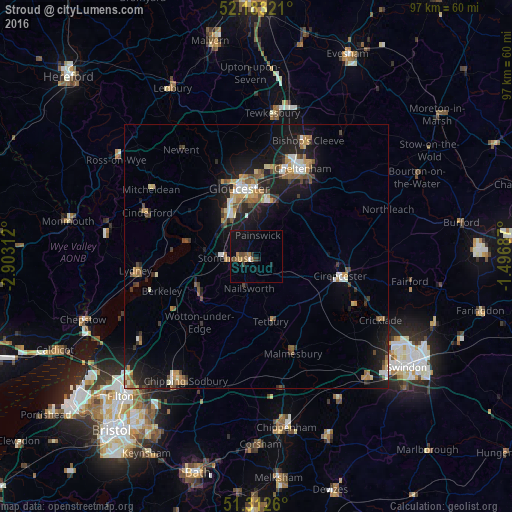
Analysis of Stroud night lights 2016
Square area 10x10 km:
 0.14%
0.14%90-99
0.42%80-89
0%70-79
0.84%60-69
2.24%50-59
1.96%40-49
1.26%30-39
1.54%20-29
0.7%10-19
6.86%0-9
84.03%Square area 50x50 km:
0.63%90-99
0.86%80-89
0.55%70-79
0.96%60-69
1.06%50-59
0.97%40-49
0.98%30-39
0.91%20-29
1.79%10-19
6.54%0-9
84.75%Clear (daylight) street map image can be seen on geolist.org.
Map coordinates:
52° 10' 59.6" North, 2° 54' 11.2" West
51° 45' 0" North, 2° 12' 0" West
51° 18' 45.4" North, 1° 29' 48.7" West
Some cities around Stroud sort by population:
• Gloucester
13.2 km =8.2 mi,  347°
347°
• Cirencester
16.1 km =10 mi,  102°
102°
• Dursley
13 km =8.1 mi,  234°
234°
• Churchdown
14.3 km =8.9 mi,  8°
8°
• Stonehouse
5.7 km =3.5 mi,  270°
270°
• Chalford
4.3 km =2.7 mi,  128°
128°
• Tetbury
12.6 km =7.8 mi,  168°
168°
• Nailsworth
6.4 km =4 mi,  192°
192°
2636616 (p: 60,155)
Sources (retrieved 2019-11-25):
» NASA, Earths city lights 1995
» NASA city lights 2003
» Earth at Night: Flat Maps 2012, 2016