Gloucester night lights from space
Night Light of Gloucester (England) from space (United Kingdom) Src. Average luminocity for 10x10km area is 40.9331% and for 50x50km: 6.2318%.
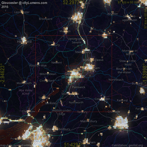
Analysis of Gloucester night lights 2016
Square area 10x10 km:
 5.3%
5.3%90-99
6.06%80-89
7.58%70-79
6.31%60-69
6.44%50-59
6.19%40-49
4.29%30-39
3.16%20-29
14.77%10-19
28.03%0-9
11.87%Square area 50x50 km:
0.57%90-99
0.9%80-89
0.56%70-79
0.85%60-69
0.99%50-59
0.84%40-49
0.89%30-39
0.79%20-29
1.4%10-19
5.23%0-9
86.96%Clear (daylight) street map image can be seen on geolist.org.
Map coordinates:
52° 17' 52" North, 2° 56' 46.4" West
51° 51' 56.4" North, 2° 14' 35.2" West
51° 25' 45.8" North, 1° 32' 23.9" West
Some cities around Gloucester sort by population:
• Cheltenham
11.8 km =7.3 mi,  71°
71°
• Stroud
13.2 km =8.2 mi,  167°
167°
• Tewkesbury
15.2 km =9.4 mi,  21°
21°
• Bishops Cleeve
15.4 km =9.6 mi,  53°
53°
• Churchdown
5.1 km =3.2 mi,  75°
75°
• Charlton Kings
13.9 km =8.6 mi, 81°
• Stonehouse
13.2 km =8.2 mi,  192°
192°
• Chalford
16.8 km =10.4 mi,  157°
157°
2648404 (p: 150,053)
Sources (retrieved 2019-11-25):
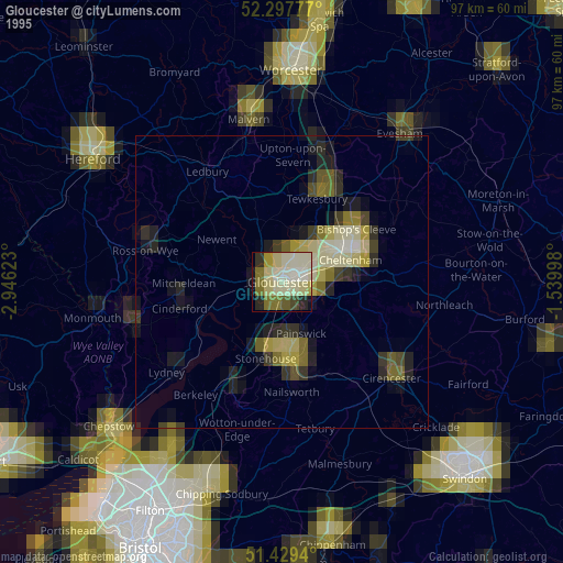
» NASA, Earths city lights 1995
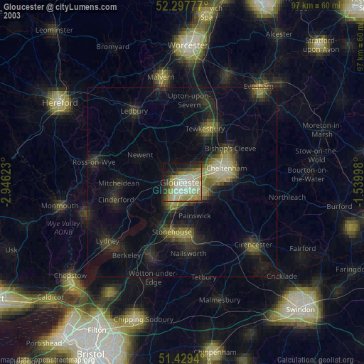
» NASA city lights 2003
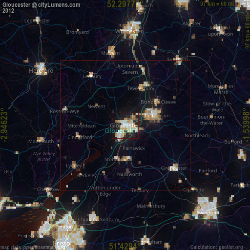
» Earth at Night: Flat Maps 2012, 2016