Monmouth night lights from space
Night Light of Monmouth (Wales) from space (United Kingdom) Src. Average luminocity for 10x10km area is 3.1106% and for 50x50km: 4.5401%.
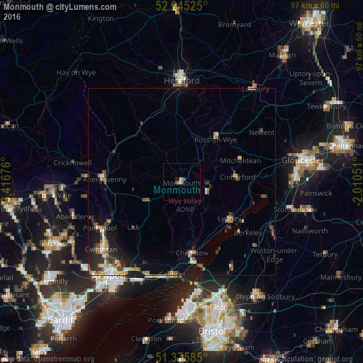
Analysis of Monmouth night lights 2016
Square area 10x10 km:
 0%
0%90-99
0.14%80-89
0.98%70-79
0%60-69
1.12%50-59
0%40-49
1.4%30-39
0.28%20-29
0.56%10-19
0.56%0-9
94.96%Square area 50x50 km:
0.38%90-99
0.65%80-89
0.41%70-79
0.66%60-69
0.56%50-59
0.8%40-49
0.73%30-39
0.84%20-29
1.33%10-19
2.54%0-9
91.09%Clear (daylight) street map image can be seen on geolist.org.
Map coordinates:
52° 14' 42.9" North, 3° 25' 0.3" West
51° 48' 45.5" North, 2° 42' 49.1" West
51° 22' 33.1" North, 2° 0' 37.8" West
Some cities around Monmouth sort by population:
• Pontypool
25.9 km =16.1 mi,  241°
241°
• Chepstow
19.3 km =12 mi,  172°
172°
• Abergavenny
20.9 km =13 mi,  272°
272°
• Cinderford
14.8 km =9.2 mi,  85°
85°
• Caldicot
25.3 km =15.7 mi,  186°
186°
• Ross on Wye
15.3 km =9.5 mi,  41°
41°
• Coleford
7.1 km =4.4 mi,  105°
105°
• Lydney
16.1 km =10 mi,  126°
126°
2642313 (p: 10,110)
Sources (retrieved 2019-11-25):
» Earth at Night: Flat Maps 2012, 2016