Stonehouse night lights from space
Night Light of Stonehouse (England) from space (United Kingdom) Src. Average luminocity for 10x10km area is 10.5098% and for 50x50km: 7.0959%.
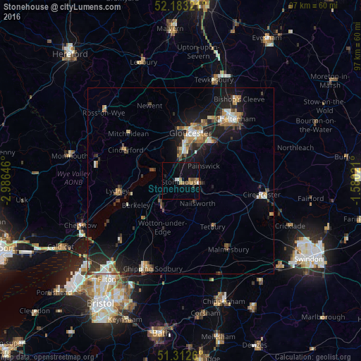
Analysis of Stonehouse night lights 2016
Square area 10x10 km:
 0.42%
0.42%90-99
1.26%80-89
0%70-79
1.26%60-69
3.36%50-59
1.54%40-49
1.26%30-39
0.98%20-29
0.42%10-19
8.26%0-9
81.23%Square area 50x50 km:
0.75%90-99
1%80-89
0.55%70-79
0.96%60-69
0.99%50-59
1.04%40-49
0.96%30-39
1.15%20-29
2.03%10-19
6.37%0-9
84.2%Clear (daylight) street map image can be seen on geolist.org.
Map coordinates:
52° 10' 59.6" North, 2° 59' 11.3" West
51° 45' 0" North, 2° 16' 60" West
51° 18' 45.4" North, 1° 34' 48.8" West
Some cities around Stonehouse sort by population:
• Gloucester
13.2 km =8.2 mi,  12°
12°
• Stroud
5.7 km =3.5 mi,  90°
90°
• Dursley
9 km =5.6 mi,  212°
212°
• Churchdown
16.1 km =10 mi,  28°
28°
• Chalford
9.5 km =5.9 mi,  106°
106°
• Wotton-under-Edge
13.7 km =8.5 mi,  198°
198°
• Tetbury
14.9 km =9.3 mi,  145°
145°
• Nailsworth
7.6 km =4.7 mi, 145°
2636811 (p: 7,481)
Sources (retrieved 2019-11-25):
» Earth at Night: Flat Maps 2012, 2016