Dursley night lights from space
Night Light of Dursley (England) from space (United Kingdom) Src. Average luminocity for 10x10km area is 2.4314% and for 50x50km: 10.8739%.
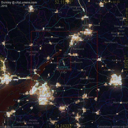
Analysis of Dursley night lights 2016
Square area 10x10 km:
 0%
0%90-99
0%80-89
0%70-79
0%60-69
0.28%50-59
1.54%40-49
1.12%30-39
0.14%20-29
1.4%10-19
0.28%0-9
95.24%Square area 50x50 km:
1.72%90-99
2.06%80-89
1.02%70-79
1.34%60-69
1.5%50-59
1.68%40-49
1.38%30-39
1.43%20-29
2.6%10-19
6.06%0-9
79.21%Clear (daylight) street map image can be seen on geolist.org.
Map coordinates:
52° 6' 54.9" North, 3° 3' 23.3" West
51° 40' 53" North, 2° 21' 12" West
51° 14' 36" North, 1° 39' 0.8" West
Some cities around Dursley sort by population:
• Stroud
13 km =8.1 mi,  54°
54°
• Thornbury
14.1 km =8.8 mi,  235°
235°
• Lydney
12.9 km =8 mi,  292°
292°
• Stonehouse
9 km =5.6 mi,  32°
32°
• Chalford
14.8 km =9.2 mi,  70°
70°
• Wotton-under-Edge
5.5 km =3.4 mi,  174°
174°
• Tetbury
14 km =8.7 mi,  109°
109°
• Nailsworth
9.3 km =5.8 mi,  81°
81°
2650613 (p: 14,992)
Sources (retrieved 2019-11-25):
» Earth at Night: Flat Maps 2012, 2016