Potters Bar night lights from space
Night Light of Potters Bar (England) from space (United Kingdom) Src. Average luminocity for 10x10km area is 44.1737% and for 50x50km: 54.4476%.
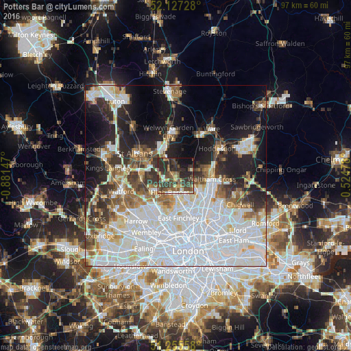
Analysis of Potters Bar night lights 2016
Square area 10x10 km:
 3.64%
3.64%90-99
3.64%80-89
5.88%70-79
4.2%60-69
5.88%50-59
10.5%40-49
14.29%30-39
17.65%20-29
22.55%10-19
8.96%0-9
2.8%Square area 50x50 km:
21.76%90-99
12.94%80-89
4.58%70-79
3.3%60-69
4.45%50-59
4.91%40-49
4.39%30-39
5.76%20-29
8.12%10-19
12.39%0-9
17.41%Clear (daylight) street map image can be seen on geolist.org.
Map coordinates:
52° 7' 38.2" North, 0° 52' 53.3" West
51° 41' 36.7" North, 0° 10' 42.1" West
51° 15' 20.1" North, 0° 31' 29.2" East
Some cities around Potters Bar sort by population:
• Enfield Town
8 km =5 mi,  125°
125°
• Hatfield
8.4 km =5.2 mi,  337°
337°
• Borehamwood
8.1 km =5 mi,  237°
237°
• Barnet
5.1 km =3.2 mi,  197°
197°
• Hadley Wood
3 km =1.9 mi,  168°
168°
• Waltham Cross
9.9 km =6.2 mi,  94°
94°
• Radlett
9.7 km =6 mi,  265°
265°
• High Barnet
4.6 km =2.9 mi,  205°
205°
2639970 (p: 22,639)
Sources (retrieved 2019-11-25):
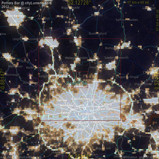
» Earth at Night: Flat Maps 2012, 2016