Ware night lights from space
Night Light of Ware (England) from space (United Kingdom) Src. Average luminocity for 10x10km area is 21.0686% and for 50x50km: 28.0736%.
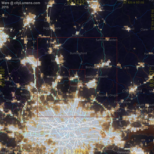
Analysis of Ware night lights 2016
Square area 10x10 km:
 2.24%
2.24%90-99
1.68%80-89
1.54%70-79
1.68%60-69
2.24%50-59
4.48%40-49
4.9%30-39
4.76%20-29
4.62%10-19
27.45%0-9
44.4%Square area 50x50 km:
5.86%90-99
5.96%80-89
2.77%70-79
2.37%60-69
3.7%50-59
4.12%40-49
3.82%30-39
4.48%20-29
6.52%10-19
13.99%0-9
46.4%Clear (daylight) street map image can be seen on geolist.org.
Map coordinates:
52° 14' 35.5" North, 0° 43' 54.8" West
51° 48' 38.1" North, 0° 1' 43.5" West
51° 22' 25.5" North, 0° 40' 27.7" East
Some cities around Ware sort by population:
• Harlow
10.4 km =6.5 mi,  111°
111°
• Welwyn Garden City
12.3 km =7.6 mi,  265°
265°
• Cheshunt
12.3 km =7.6 mi,  180°
180°
• Hoddesdon
5.6 km =3.5 mi,  167°
167°
• Hertford
3.8 km =2.4 mi,  244°
244°
• Broxbourne
7.1 km =4.4 mi, 174°
• Sawbridgeworth
12.3 km =7.6 mi,  86°
86°
• Old Harlow
11.6 km =7.2 mi, 105°
2634777 (p: 17,576)
Sources (retrieved 2019-11-25):
» Earth at Night: Flat Maps 2012, 2016