Blyth night lights from space
Night Light of Blyth (England) from space (United Kingdom) Src. Average luminocity for 10x10km area is 27.8221% and for 50x50km: 16.6452%.
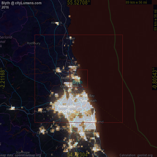
Analysis of Blyth night lights 2016
Square area 10x10 km:
 1.88%
1.88%90-99
4.89%80-89
4.01%70-79
2.38%60-69
3.01%50-59
4.64%40-49
3.13%30-39
2.76%20-29
22.43%10-19
20.18%0-9
30.7%Square area 50x50 km:
5.55%90-99
4.15%80-89
1.56%70-79
1.34%60-69
1.21%50-59
1.34%40-49
1.11%30-39
2.18%20-29
3.46%10-19
4.66%0-9
73.43%Clear (daylight) street map image can be seen on geolist.org.
Map coordinates:
55° 31' 37.5" North, 2° 12' 42" West
55° 7' 37.5" North, 1° 30' 30.8" West
54° 43' 22.9" North, 0° 48' 19.5" West
Some cities around Blyth sort by population:
• Whitley Bay
10.5 km =6.5 mi,  158°
158°
• Cramlington
6.7 km =4.2 mi,  227°
227°
• Ashington
6.6 km =4.1 mi,  327°
327°
• Bedlington
5.4 km =3.4 mi,  274°
274°
• Stakeford
5.7 km =3.5 mi,  311°
311°
• Seaton Delaval
6.2 km =3.9 mi,  190°
190°
• Wideopen
11.6 km =7.2 mi,  218°
218°
• Newbiggin-by-the-Sea
6.5 km =4 mi,  356°
356°
2655315 (p: 37,339)
Sources (retrieved 2019-11-25):
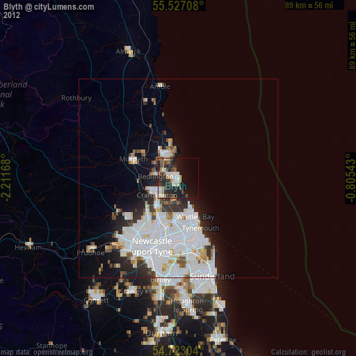
» Earth at Night: Flat Maps 2012, 2016