Whitley Bay night lights from space
Night Light of Whitley Bay (England) from space (United Kingdom) Src. Average luminocity for 10x10km area is 47.8271% and for 50x50km: 21.8749%.
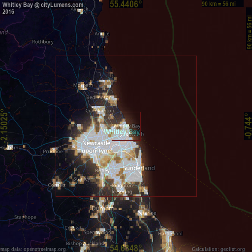
Analysis of Whitley Bay night lights 2016
Square area 10x10 km:
 16.42%
90-99
14.41%80-89
2.76%70-79
1.38%60-69
3.13%50-59
3.01%40-49
1.88%30-39
6.77%20-29
18.17%10-19
16.04%0-9
16.04%Square area 50x50 km:
7.21%90-99
5.1%80-89
1.85%70-79
1.66%60-69
1.81%50-59
1.88%40-49
1.78%30-39
3.48%20-29
5.05%10-19
6.02%0-9
64.14%Clear (daylight) street map image can be seen on geolist.org.
Map coordinates:
55° 26' 26.2" North, 2° 9' 0.9" West
55° 2' 23" North, 1° 26' 49.7" West
54° 38' 5.3" North, 0° 44' 38.4" West
Some cities around Whitley Bay sort by population:
• South Shields
4.7 km =2.9 mi,  168°
168°
• Wallsend
7.7 km =4.8 mi,  225°
225°
• North Shields
2.6 km =1.6 mi,  182°
182°
• Cramlington
10.3 km =6.4 mi,  300°
300°
• Jarrow
7 km =4.3 mi,  199°
199°
• Hebburn
8.6 km =5.3 mi,  210°
210°
• Tynemouth
2.8 km =1.7 mi,  150°
150°
• Seaton Delaval
6.2 km =3.9 mi,  305°
305°
2634032 (p: 38,055)
Sources (retrieved 2019-11-25):
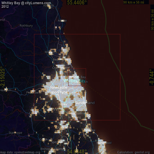
» Earth at Night: Flat Maps 2012, 2016