Norton Canes night lights from space
Night Light of Norton Canes (England) from space (United Kingdom) Src. Average luminocity for 10x10km area is 60.381% and for 50x50km: 35.1531%.
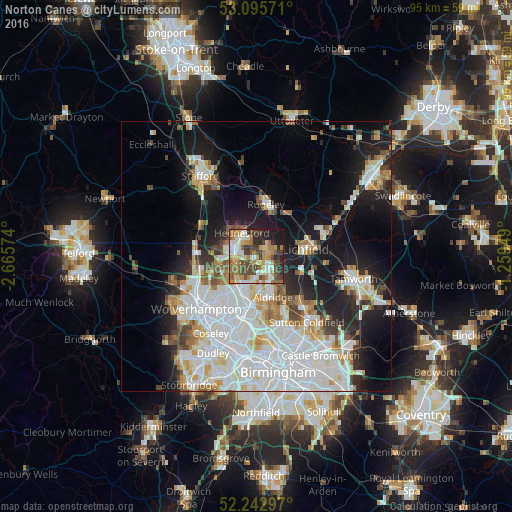
Analysis of Norton Canes night lights 2016
Square area 10x10 km:
 8.99%
8.99%90-99
11.24%80-89
7.28%70-79
11.77%60-69
12.3%50-59
8.6%40-49
14.29%30-39
8.73%20-29
9.79%10-19
7.01%0-9
0%Square area 50x50 km:
11.57%90-99
9.07%80-89
2.95%70-79
3.12%60-69
3.23%50-59
2.55%40-49
3.03%30-39
2.42%20-29
5.72%10-19
14.38%0-9
41.96%Clear (daylight) street map image can be seen on geolist.org.
Map coordinates:
53° 5' 44.6" North, 2° 39' 56.7" West
52° 40' 17.1" North, 1° 57' 45.4" West
52° 14' 34.7" North, 1° 15' 34.2" West
Some cities around Norton Canes sort by population:
• Cannock
5.1 km =3.2 mi,  294°
294°
• Bloxwich
6.6 km =4.1 mi,  205°
205°
• Burntwood
2.6 km =1.6 mi,  66°
66°
• Brownhills
4.7 km =2.9 mi,  154°
154°
• Great Wyrley
3.4 km =2.1 mi,  253°
253°
• Aldridge
7.9 km =4.9 mi,  157°
157°
• Pelsall
4.7 km =2.9 mi,  183°
183°
• Chasetown
2.5 km =1.6 mi,  87°
87°
2641193 (p: 7,479)
Sources (retrieved 2019-11-25):
» Earth at Night: Flat Maps 2012, 2016