Great Wyrley night lights from space
Night Light of Great Wyrley (England) from space (United Kingdom) Src. Average luminocity for 10x10km area is 65.9312% and for 50x50km: 34.8878%.
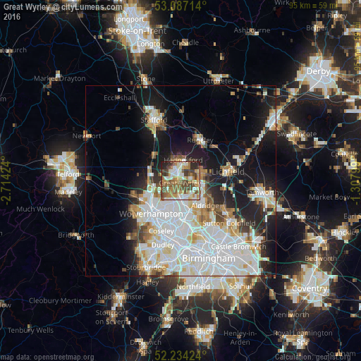
Analysis of Great Wyrley night lights 2016
Square area 10x10 km:
 10.98%
90-99
13.1%80-89
7.94%70-79
10.85%60-69
15.21%50-59
12.43%40-49
14.29%30-39
7.54%20-29
7.14%10-19
0.53%0-9
0%Square area 50x50 km:
11.67%90-99
9.28%80-89
2.99%70-79
3.04%60-69
3.11%50-59
2.43%40-49
2.95%30-39
2.38%20-29
5.34%10-19
12.98%0-9
43.82%Clear (daylight) street map image can be seen on geolist.org.
Map coordinates:
53° 5' 13.7" North, 2° 42' 51.3" West
52° 39' 46" North, 2° 0' 40" West
52° 14' 3.3" North, 1° 18' 28.8" West
Some cities around Great Wyrley sort by population:
• Cannock
3.4 km =2.1 mi,  336°
336°
• Bloxwich
5 km =3.1 mi,  174°
174°
• Burntwood
6 km =3.7 mi,  70°
70°
• Brownhills
6.2 km =3.9 mi,  121°
121°
• Featherstone
5.9 km =3.7 mi,  250°
250°
• Pelsall
4.8 km =3 mi,  141°
141°
• Chasetown
5.9 km =3.7 mi,  79°
79°
• Norton Canes
3.4 km =2.1 mi, 73°
2647985 (p: 19,193)
Sources (retrieved 2019-11-25):
» Earth at Night: Flat Maps 2012, 2016