Basford night lights from space
Night Light of Basford (England) from space (United Kingdom) Src. Average luminocity for 10x10km area is 91.9206% and for 50x50km: 26.8184%.
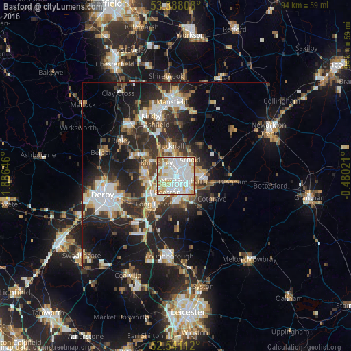
Analysis of Basford night lights 2016
Square area 10x10 km:
 37.3%
37.3%90-99
34.52%80-89
11.24%70-79
9.79%60-69
5.16%50-59
1.72%40-49
0.26%30-39
0%20-29
0%10-19
0%0-9
0%Square area 50x50 km:
5.14%90-99
5.5%80-89
2.71%70-79
2.45%60-69
2.99%50-59
3.17%40-49
3.35%30-39
4.65%20-29
9.72%10-19
15.62%0-9
44.69%Clear (daylight) street map image can be seen on geolist.org.
Map coordinates:
53° 23' 17.1" North, 1° 53' 11.3" West
52° 58' 0" North, 1° 10' 60" West
52° 32' 28" North, 0° 28' 48.8" West
Some cities around Basford sort by population:
• Nottingham
2.6 km =1.6 mi,  123°
123°
• West Bridgford
5.6 km =3.5 mi,  136°
136°
• Ilkeston
8.5 km =5.3 mi,  272°
272°
• Arnold
5 km =3.1 mi,  42°
42°
• Hucknall
7.5 km =4.7 mi,  351°
351°
• Kimberley
5.9 km =3.7 mi,  288°
288°
• New Basford
1.4 km =0.9 mi,  57°
57°
• Ruddington
8.5 km =5.3 mi,  164°
164°
2656196 (p: 16,000)
Sources (retrieved 2019-11-25):
» Earth at Night: Flat Maps 2012, 2016