Ruddington night lights from space
Night Light of Ruddington (England) from space (United Kingdom) Src. Average luminocity for 10x10km area is 45.8283% and for 50x50km: 25.7753%.
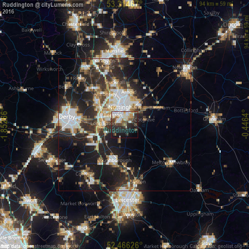
Analysis of Ruddington night lights 2016
Square area 10x10 km:
 10.48%
90-99
10.48%80-89
5.18%70-79
2.9%60-69
3.41%50-59
6.06%40-49
6.94%30-39
7.32%20-29
16.79%10-19
20.33%0-9
10.1%Square area 50x50 km:
4.73%90-99
5.06%80-89
2.42%70-79
2.31%60-69
3.16%50-59
3.24%40-49
3.44%30-39
4.57%20-29
9.48%10-19
16.04%0-9
45.56%Clear (daylight) street map image can be seen on geolist.org.
Map coordinates:
53° 18' 52.8" North, 1° 51' 9.6" West
52° 53' 33.1" North, 1° 8' 58.3" West
52° 27' 58.5" North, 0° 26' 47" West
Some cities around Ruddington sort by population:
• Nottingham
6.8 km =4.2 mi,  359°
359°
• West Bridgford
4.4 km =2.7 mi,  21°
21°
• Long Eaton
8.2 km =5.1 mi,  274°
274°
• Basford
8.5 km =5.3 mi,  344°
344°
• New Basford
9.1 km =5.7 mi,  353°
353°
• Cotgrave
7.7 km =4.8 mi,  76°
76°
• Keyworth
4.7 km =2.9 mi,  120°
120°
• East Leake
7.3 km =4.5 mi,  196°
196°
2638995 (p: 6,404)
Sources (retrieved 2019-11-25):
» Earth at Night: Flat Maps 2012, 2016