Ilkeston night lights from space
Night Light of Ilkeston (England) from space (United Kingdom) Src. Average luminocity for 10x10km area is 53.7725% and for 50x50km: 28.3751%.
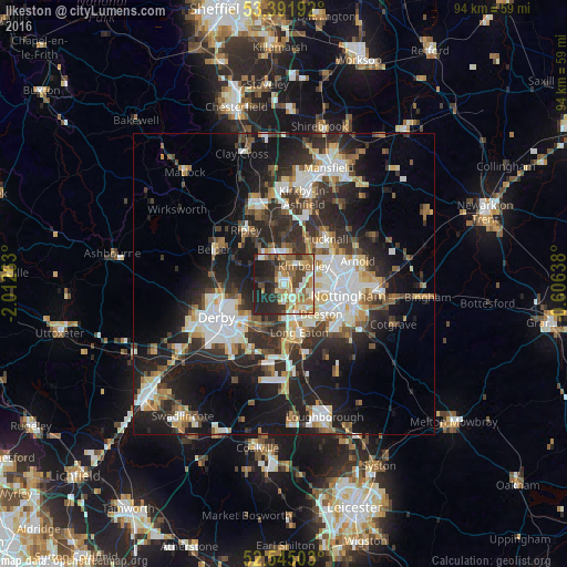

Analysis of Ilkeston night lights 2016
Square area 10x10 km:
 5.03%
5.03%90-99
12.04%80-89
7.94%70-79
9.39%60-69
10.71%50-59
7.94%40-49
8.6%30-39
7.28%20-29
18.52%10-19
12.57%0-9
0%Square area 50x50 km:
5.36%90-99
5.77%80-89
2.81%70-79
2.78%60-69
3.19%50-59
3.2%40-49
3.57%30-39
4.88%20-29
10.73%10-19
17.12%0-9
40.58%Clear (daylight) street map image can be seen on geolist.org.
Map coordinates:
53° 23' 30.9" North, 2° 0' 45.5" West
52° 58' 14" North, 1° 18' 34.2" West
52° 32' 42.1" North, 0° 36' 23" West
Some cities around Ilkeston sort by population:
• Long Eaton
8.4 km =5.2 mi,  162°
162°
• Heanor
5.6 km =3.5 mi,  328°
328°
• Ripley
9.2 km =5.7 mi,  319°
319°
• Eastwood
3.3 km =2.1 mi,  11°
11°
• Basford
8.5 km =5.3 mi,  92°
92°
• Kimberley
3.2 km =2 mi,  63°
63°
• West Hallam
3.3 km =2.1 mi,  270°
270°
• Borrowash
8.7 km =5.4 mi,  215°
215°
2646274 (p: 38,587)
Sources (retrieved 2019-11-25):
» Earth at Night: Flat Maps 2012, 2016