Barnt Green night lights from space
Night Light of Barnt Green (England) from space (United Kingdom) Src. Average luminocity for 10x10km area is 42.3927% and for 50x50km: 32.3287%.
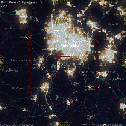
Analysis of Barnt Green night lights 2016
Square area 10x10 km:
 7.07%
7.07%90-99
8.71%80-89
3.79%70-79
2.9%60-69
4.17%50-59
4.67%40-49
6.19%30-39
10.73%20-29
24.37%10-19
27.4%0-9
0%Square area 50x50 km:
10.71%90-99
8.91%80-89
2.69%70-79
2.43%60-69
2.6%50-59
2.11%40-49
2.83%30-39
2.94%20-29
5.93%10-19
10.44%0-9
48.41%Clear (daylight) street map image can be seen on geolist.org.
Map coordinates:
52° 47' 10.8" North, 2° 42' 37" West
52° 21' 32.5" North, 2° 0' 25.7" West
51° 55' 39.1" North, 1° 18' 14.5" West
Some cities around Barnt Green sort by population:
• Redditch
7.2 km =4.5 mi,  144°
144°
• Halesowen
10.4 km =6.5 mi,  343°
343°
• Bromsgrove
4.4 km =2.7 mi,  234°
234°
• Shirley
14 km =8.7 mi,  65°
65°
• Bartley Green
8.5 km =5.3 mi,  4°
4°
• Studley
12.6 km =7.8 mi, 141°
• Hagley
11.1 km =6.9 mi,  312°
312°
• Cradley Heath
13.6 km =8.5 mi, 337°
2656277 (p: 5,366)
Sources (retrieved 2019-11-25):
» Earth at Night: Flat Maps 2012, 2016