Halesowen night lights from space
Night Light of Halesowen (England) from space (United Kingdom) Src. Average luminocity for 10x10km area is 71.7273% and for 50x50km: 37.7804%.
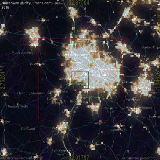
Analysis of Halesowen night lights 2016
Square area 10x10 km:
 22.85%
90-99
25.63%80-89
8.08%70-79
3.91%60-69
4.17%50-59
5.43%40-49
4.55%30-39
9.34%20-29
11.11%10-19
4.92%0-9
0%Square area 50x50 km:
12.37%90-99
10.2%80-89
3.1%70-79
3.24%60-69
3.33%50-59
2.87%40-49
3.53%30-39
3.29%20-29
7.16%10-19
11.24%0-9
39.68%Clear (daylight) street map image can be seen on geolist.org.
Map coordinates:
52° 52' 30.1" North, 2° 45' 9" West
52° 26' 54.9" North, 2° 2' 57.8" West
52° 1' 4.7" North, 1° 20' 46.5" West
Some cities around Halesowen sort by population:
• Dudley
6.2 km =3.9 mi,  338°
338°
• Stourbridge
6.4 km =4 mi,  277°
277°
• Brierley Hill
6.1 km =3.8 mi,  307°
307°
• Bartley Green
3.8 km =2.4 mi,  112°
112°
• Smethwick
7.4 km =4.6 mi,  48°
48°
• Oldbury
6.1 km =3.8 mi,  21°
21°
• Hagley
5.9 km =3.7 mi,  245°
245°
• Cradley Heath
3.4 km =2.1 mi,  319°
319°
2647639 (p: 55,265)
Sources (retrieved 2019-11-25):
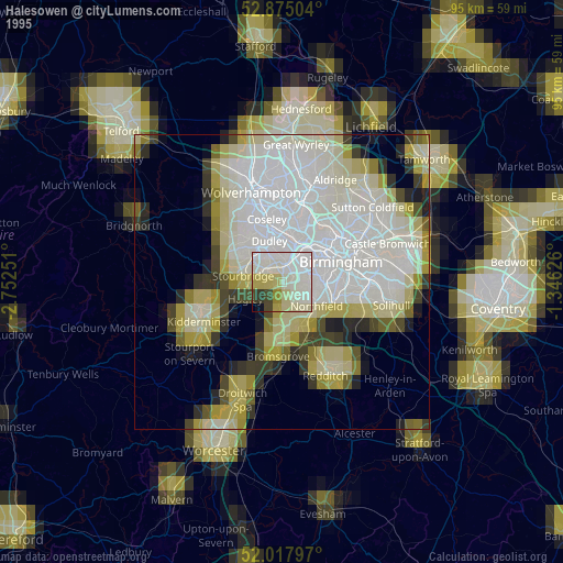
» NASA, Earths city lights 1995
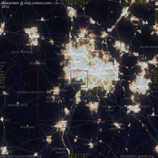
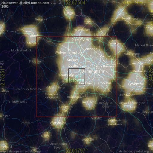
» NASA city lights 2003
» Earth at Night: Flat Maps 2012, 2016