Studley night lights from space
Night Light of Studley (England) from space (United Kingdom) Src. Average luminocity for 10x10km area is 24.9008% and for 50x50km: 23.6671%.
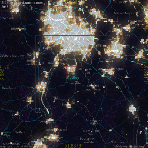
Analysis of Studley night lights 2016
Square area 10x10 km:
 3.04%
3.04%90-99
6.48%80-89
1.59%70-79
4.5%60-69
3.04%50-59
2.91%40-49
2.78%30-39
1.06%20-29
4.89%10-19
20.24%0-9
49.47%Square area 50x50 km:
6.05%90-99
6.04%80-89
1.94%70-79
2.21%60-69
2.17%50-59
1.92%40-49
2.32%30-39
2.66%20-29
5.73%10-19
11.49%0-9
57.46%Clear (daylight) street map image can be seen on geolist.org.
Map coordinates:
52° 41' 54.4" North, 2° 35' 42" West
52° 16' 12.9" North, 1° 53' 30.8" West
51° 50' 16.4" North, 1° 11' 19.5" West
Some cities around Studley sort by population:
• Redditch
5.4 km =3.4 mi,  317°
317°
• Bromsgrove
13.5 km =8.4 mi,  302°
302°
• Shirley
16.4 km =10.2 mi,  17°
17°
• Stratford-upon-Avon
15.3 km =9.5 mi,  124°
124°
• Dorridge
14.8 km =9.2 mi,  39°
39°
• Alcester
6.2 km =3.9 mi,  163°
163°
• Barnt Green
12.6 km =7.8 mi, 321°
• Bidford-on-Avon
11.4 km =7.1 mi,  168°
168°
2636594 (p: 6,203)
Sources (retrieved 2019-11-25):
» Earth at Night: Flat Maps 2012, 2016