Montdidier night lights from space
Night Light of Montdidier (Hauts-de-France) from space (France) Src. Average luminocity for 10x10km area is 5.9482% and for 50x50km: 6.6304%.
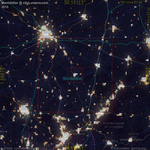
Analysis of Montdidier night lights 2016
Square area 10x10 km:
 0.56%
0.56%90-99
1.68%80-89
0.56%70-79
1.54%60-69
0.7%50-59
0%40-49
0.56%30-39
0%20-29
0%10-19
0.56%0-9
93.84%Square area 50x50 km:
0.74%90-99
1.01%80-89
0.6%70-79
0.86%60-69
0.88%50-59
0.82%40-49
0.6%30-39
1.06%20-29
1.76%10-19
3.63%0-9
88.04%Clear (daylight) street map image can be seen on geolist.org.
Map coordinates:
50° 6' 4.1" North, 1° 52' 0.4" East
49° 38' 52.8" North, 2° 34' 11.7" East
49° 11' 26.2" North, 3° 16' 22.9" East
Some cities around Montdidier sort by population:
• Compiègne
31.6 km =19.6 mi,  144°
144°
• Noyon
31.8 km =19.8 mi,  103°
103°
• Margny-lès-Compiègne
30.5 km =19 mi, 144°
• Roye
16.8 km =10.4 mi,  69°
69°
• Corbie
29.1 km =18.1 mi,  351°
351°
• Saint-Just-en-Chaussée
18.7 km =11.6 mi,  211°
211°
• Thourotte
29.5 km =18.3 mi,  130°
130°
• Longueau
29.2 km =18.1 mi,  328°
328°
2992760 (p: 6,556)
Sources (retrieved 2019-11-25):
» Earth at Night: Flat Maps 2012, 2016