Longueau night lights from space
Night Light of Longueau (Hauts-de-France) from space (France) Src. Average luminocity for 10x10km area is 44.2981% and for 50x50km: 7.3997%.
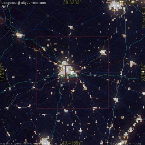
Analysis of Longueau night lights 2016
Square area 10x10 km:
 10.96%
90-99
12.57%80-89
3.21%70-79
3.21%60-69
4.95%50-59
1.87%40-49
2.67%30-39
7.35%20-29
16.71%10-19
21.52%0-9
14.97%Square area 50x50 km:
1.03%90-99
1.33%80-89
0.72%70-79
0.82%60-69
0.85%50-59
0.94%40-49
0.79%30-39
1.18%20-29
2.45%10-19
3.93%0-9
85.96%Clear (daylight) street map image can be seen on geolist.org.
Map coordinates:
50° 19' 23.9" North, 1° 39' 20.4" East
49° 52' 20.1" North, 2° 21' 31.7" East
49° 25' 1.1" North, 3° 3' 42.9" East
Some cities around Longueau sort by population:
• Amiens
5.2 km =3.2 mi,  306°
306°
• Albert
25.3 km =15.7 mi,  55°
55°
• Péronne
41.9 km =26 mi,  80°
80°
• Roye
36.4 km =22.6 mi,  121°
121°
• Montdidier
29.2 km =18.1 mi,  148°
148°
• Corbie
11.3 km =7 mi,  70°
70°
• Doullens
31.7 km =19.7 mi,  357°
357°
• Saint-Just-en-Chaussée
41.2 km =25.6 mi,  172°
172°
2997681 (p: 5,180)
Sources (retrieved 2019-11-25):
» Earth at Night: Flat Maps 2012, 2016