Compiègne night lights from space
Night Light of Compiègne (Hauts-de-France) from space (France) Src. Average luminocity for 10x10km area is 37.8168% and for 50x50km: 9.0046%.
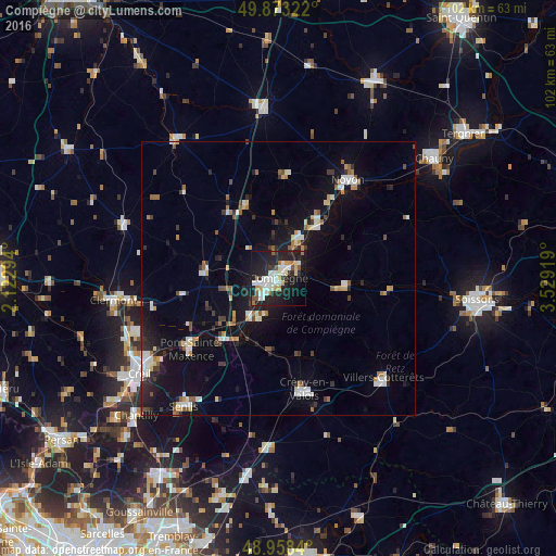
Analysis of Compiègne night lights 2016
Square area 10x10 km:
 8.29%
8.29%90-99
9.49%80-89
2.67%70-79
4.01%60-69
3.61%50-59
2.41%40-49
1.34%30-39
2.41%20-29
20.72%10-19
31.95%0-9
13.1%Square area 50x50 km:
1.41%90-99
1.45%80-89
0.67%70-79
0.77%60-69
0.98%50-59
0.95%40-49
0.78%30-39
1.09%20-29
2.53%10-19
7.64%0-9
81.74%Clear (daylight) street map image can be seen on geolist.org.
Map coordinates:
49° 52' 23.6" North, 2° 7' 22.6" East
49° 25' 4.6" North, 2° 49' 33.8" East
48° 57' 30.2" North, 3° 31' 45.1" East
Some cities around Compiègne sort by population:
• Crépy-en-Valois
21 km =13 mi,  167°
167°
• Noyon
22.3 km =13.9 mi,  34°
34°
• Pont-Sainte-Maxence
20.6 km =12.8 mi,  231°
231°
• Villers-Cotterêts
26.5 km =16.5 mi,  133°
133°
• Margny-lès-Compiègne
1 km =0.6 mi,  325°
325°
• Liancourt
27.8 km =17.3 mi,  249°
249°
• Villers-Saint-Paul
28.3 km =17.6 mi,  239°
239°
• Thourotte
7.6 km =4.7 mi, 32°
3024066 (p: 44,243)
Sources (retrieved 2019-11-25):
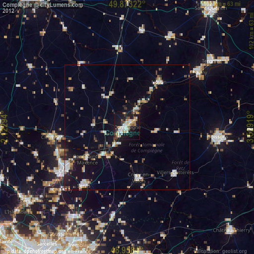
» Earth at Night: Flat Maps 2012, 2016