Margny-lès-Compiègne night lights from space
Night Light of Margny-lès-Compiègne (Hauts-de-France) from space (France) Src. Average luminocity for 10x10km area is 38.7126% and for 50x50km: 9.2684%.
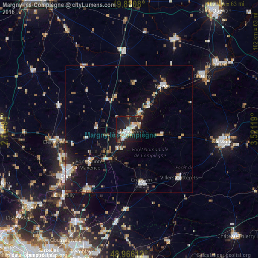
Analysis of Margny-lès-Compiègne night lights 2016
Square area 10x10 km:
 8.29%
8.29%90-99
9.63%80-89
2.67%70-79
4.14%60-69
3.61%50-59
2.94%40-49
1.47%30-39
2.81%20-29
20.72%10-19
32.89%0-9
10.83%Square area 50x50 km:
1.49%90-99
1.54%80-89
0.69%70-79
0.81%60-69
0.98%50-59
0.94%40-49
0.8%30-39
1.18%20-29
2.63%10-19
7.64%0-9
81.31%Clear (daylight) street map image can be seen on geolist.org.
Map coordinates:
49° 52' 50.9" North, 2° 6' 53.8" East
49° 25' 32.1" North, 2° 49' 5" East
48° 57' 58" North, 3° 31' 16.3" East
Some cities around Margny-lès-Compiègne sort by population:
• Compiègne
1 km =0.6 mi,  145°
145°
• Crépy-en-Valois
21.9 km =13.6 mi,  166°
166°
• Noyon
21.9 km =13.6 mi,  36°
36°
• Pont-Sainte-Maxence
20.7 km =12.9 mi,  228°
228°
• Villers-Cotterêts
27.5 km =17.1 mi,  134°
134°
• Liancourt
27.6 km =17.1 mi,  247°
247°
• Villers-Saint-Paul
28.2 km =17.5 mi,  237°
237°
• Thourotte
7.3 km =4.5 mi, 39°
2995790 (p: 7,011)
Sources (retrieved 2019-11-25):
» Earth at Night: Flat Maps 2012, 2016