Saint-Just-en-Chaussée night lights from space
Night Light of Saint-Just-en-Chaussée (Hauts-de-France) from space (France) Src. Average luminocity for 10x10km area is 7.1681% and for 50x50km: 8.61%.
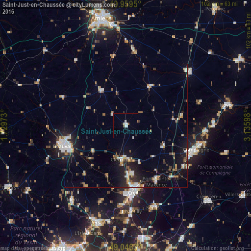
Analysis of Saint-Just-en-Chaussée night lights 2016
Square area 10x10 km:
 1.68%
1.68%90-99
1.4%80-89
0.56%70-79
0%60-69
1.12%50-59
0.56%40-49
0.56%30-39
0.28%20-29
0.84%10-19
1.68%0-9
91.32%Square area 50x50 km:
1.15%90-99
1.39%80-89
0.62%70-79
0.87%60-69
1.09%50-59
1.02%40-49
1.13%30-39
1.17%20-29
2.1%10-19
5.98%0-9
83.48%Clear (daylight) street map image can be seen on geolist.org.
Map coordinates:
49° 57' 34.2" North, 1° 43' 47" East
49° 30' 18.1" North, 2° 25' 58.3" East
49° 2' 46.7" North, 3° 8' 9.5" East
Some cities around Saint-Just-en-Chaussée sort by population:
• Beauvais
26.5 km =16.5 mi,  252°
252°
• Nogent-sur-Oise
26.1 km =16.2 mi,  173°
173°
• Pont-Sainte-Maxence
25.8 km =16 mi,  151°
151°
• Clermont
14.1 km =8.8 mi,  185°
185°
• Liancourt
19.6 km =12.2 mi, 172°
• Montdidier
18.7 km =11.6 mi,  31°
31°
• Villers-Saint-Paul
24.4 km =15.2 mi, 170°
• Mouy
22.6 km =14 mi,  201°
201°
2979010 (p: 5,756)
Sources (retrieved 2019-11-25):
» Earth at Night: Flat Maps 2012, 2016