Doullens night lights from space
Night Light of Doullens (Hauts-de-France) from space (France) Src. Average luminocity for 10x10km area is 6.6016% and for 50x50km: 3.0543%.
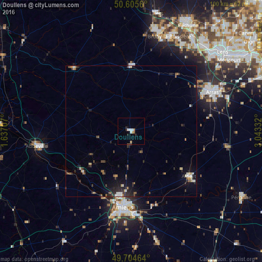
Analysis of Doullens night lights 2016
Square area 10x10 km:
 1.34%
1.34%90-99
1.34%80-89
0%70-79
1.07%60-69
0.8%50-59
0.27%40-49
0.8%30-39
0.13%20-29
2.01%10-19
0.53%0-9
91.71%Square area 50x50 km:
0.26%90-99
0.39%80-89
0.3%70-79
0.28%60-69
0.3%50-59
0.47%40-49
0.49%30-39
0.58%20-29
1.11%10-19
1.82%0-9
94%Clear (daylight) street map image can be seen on geolist.org.
Map coordinates:
50° 36' 20.2" North, 1° 38' 13.5" East
50° 9' 26.1" North, 2° 20' 24.7" East
49° 42' 16.7" North, 3° 2' 36" East
Some cities around Doullens sort by population:
• Amiens
28.7 km =17.8 mi,  185°
185°
• Arras
34.9 km =21.7 mi,  64°
64°
• Albert
28.2 km =17.5 mi,  128°
128°
• Achicourt
32.4 km =20.1 mi,  66°
66°
• Corbie
30.3 km =18.8 mi,  156°
156°
• Saint-Pol-sur-Ternoise
24.9 km =15.5 mi,  358°
358°
• Dainville
30.7 km =19.1 mi, 63°
• Longueau
31.7 km =19.7 mi,  177°
177°
3020944 (p: 6,295)
Sources (retrieved 2019-11-25):
» Earth at Night: Flat Maps 2012, 2016