Péronne night lights from space
Night Light of Péronne (Hauts-de-France) from space (France) Src. Average luminocity for 10x10km area is 12.5574% and for 50x50km: 4.8482%.
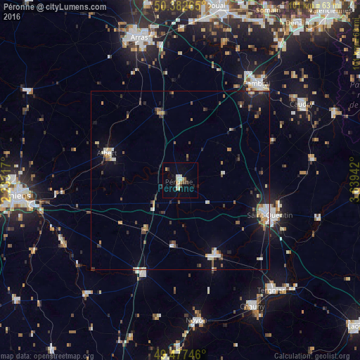
Analysis of Péronne night lights 2016
Square area 10x10 km:
 1.82%
1.82%90-99
2.52%80-89
1.4%70-79
2.1%60-69
0.42%50-59
0.7%40-49
1.12%30-39
1.54%20-29
1.4%10-19
2.8%0-9
84.17%Square area 50x50 km:
0.52%90-99
0.75%80-89
0.54%70-79
0.58%60-69
0.34%50-59
0.73%40-49
0.62%30-39
0.6%20-29
1.21%10-19
3.15%0-9
90.96%Clear (daylight) street map image can be seen on geolist.org.
Map coordinates:
50° 22' 57.5" North, 2° 13' 59.4" East
49° 55' 55.8" North, 2° 56' 10.7" East
49° 28' 38.9" North, 3° 38' 21.9" East
Some cities around Péronne sort by population:
• Saint-Quentin
26.8 km =16.7 mi,  110°
110°
• Cambrai
34.5 km =21.4 mi,  38°
38°
• Albert
21.8 km =13.5 mi,  290°
290°
• Roye
27.8 km =17.3 mi,  202°
202°
• Corbie
30.9 km =19.2 mi,  264°
264°
• Bohain-en-Vermandois
37.5 km =23.3 mi,  80°
80°
• Ham
22.8 km =14.2 mi,  154°
154°
• Gauchy
26.8 km =16.7 mi,  115°
115°
2987928 (p: 9,011)
Sources (retrieved 2019-11-25):
» Earth at Night: Flat Maps 2012, 2016