Albert night lights from space
Night Light of Albert (Hauts-de-France) from space (France) Src. Average luminocity for 10x10km area is 14.9776% and for 50x50km: 5.3688%.
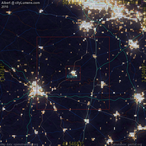
Analysis of Albert night lights 2016
Square area 10x10 km:
 1.54%
1.54%90-99
3.22%80-89
4.2%70-79
1.12%60-69
0.14%50-59
1.96%40-49
0.14%30-39
0.56%20-29
2.38%10-19
7.14%0-9
77.59%Square area 50x50 km:
0.66%90-99
0.93%80-89
0.46%70-79
0.68%60-69
0.47%50-59
0.6%40-49
0.76%30-39
0.86%20-29
1.58%10-19
2.57%0-9
90.44%Clear (daylight) street map image can be seen on geolist.org.
Map coordinates:
50° 27' 2.7" North, 1° 56' 52.2" East
50° 0' 3.3" North, 2° 39' 3.5" East
49° 32' 48.6" North, 3° 21' 14.7" East
Some cities around Albert sort by population:
• Amiens
27.5 km =17.1 mi,  245°
245°
• Arras
33.8 km =21 mi,  16°
16°
• Péronne
21.8 km =13.5 mi,  110°
110°
• Achicourt
31.3 km =19.4 mi,  14°
14°
• Corbie
14.7 km =9.1 mi,  224°
224°
• Doullens
28.2 km =17.5 mi,  308°
308°
• Dainville
31.6 km =19.6 mi, 9°
• Longueau
25.3 km =15.7 mi,  235°
235°
3038271 (p: 10,588)
Sources (retrieved 2019-11-25):
» Earth at Night: Flat Maps 2012, 2016