Amiens night lights from space
Night Light of Amiens (Hauts-de-France) from space (France) Src. Average luminocity for 10x10km area is 69.2843% and for 50x50km: 7.186%.
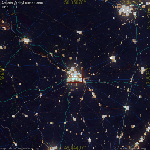
Analysis of Amiens night lights 2016
Square area 10x10 km:
 19.75%
90-99
21.15%80-89
9.1%70-79
6.44%60-69
6.02%50-59
5.6%40-49
5.04%30-39
8.82%20-29
15.27%10-19
2.8%0-9
0%Square area 50x50 km:
1%90-99
1.26%80-89
0.61%70-79
0.74%60-69
0.86%50-59
0.98%40-49
0.91%30-39
1.28%20-29
2.48%10-19
3.83%0-9
86.05%Clear (daylight) street map image can be seen on geolist.org.
Map coordinates:
50° 21' 2.8" North, 1° 35' 48.8" East
49° 54' 0" North, 2° 18' 0" East
49° 26' 41.9" North, 3° 0' 11.3" East
Some cities around Amiens sort by population:
• Abbeville
40.3 km =25 mi,  304°
304°
• Albert
27.5 km =17.1 mi,  65°
65°
• Roye
41.6 km =25.8 mi,  122°
122°
• Montdidier
34.1 km =21.2 mi,  145°
145°
• Corbie
14.8 km =9.2 mi,  87°
87°
• Doullens
28.7 km =17.8 mi,  5°
5°
• Saint-Just-en-Chaussée
44.9 km =27.9 mi,  167°
167°
• Longueau
5.2 km =3.2 mi,  126°
126°
3037854 (p: 143,086)
Sources (retrieved 2019-11-25):
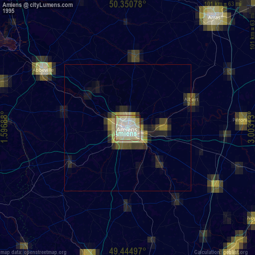
» NASA, Earths city lights 1995
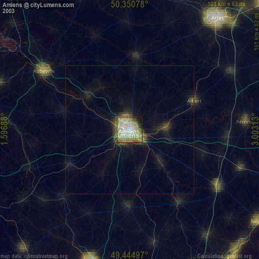
» NASA city lights 2003
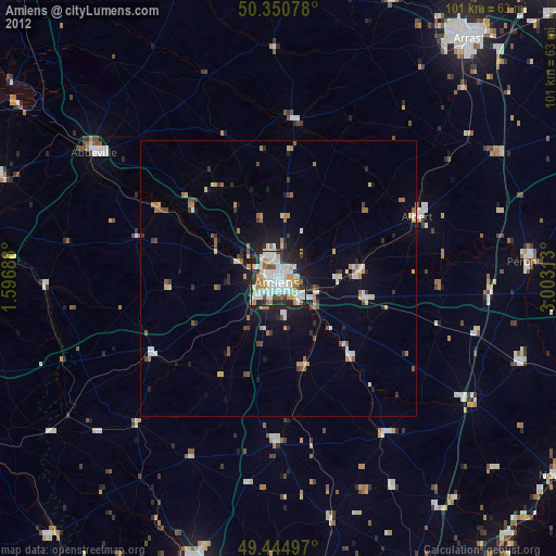
» Earth at Night: Flat Maps 2012, 2016