Fresnes night lights from space
Night Light of Fresnes (Île-de-France) from space (France) Src. Average luminocity for 10x10km area is 98.1503% and for 50x50km: 71.7405%.
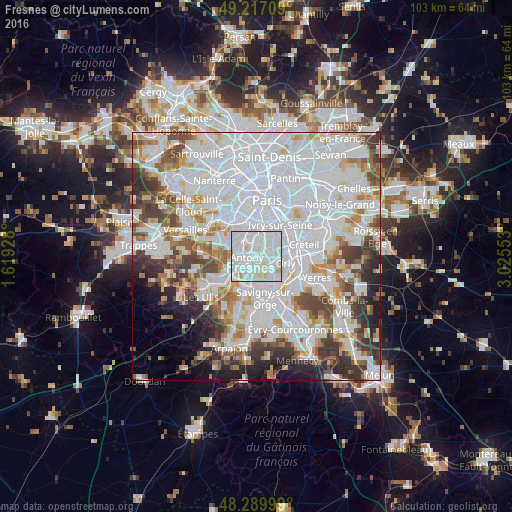
Analysis of Fresnes night lights 2016
Square area 10x10 km:
 58.93%
90-99
34.38%80-89
5.8%70-79
0.89%60-69
0%50-59
0%40-49
0%30-39
0%20-29
0%10-19
0%0-9
0%Square area 50x50 km:
33.85%90-99
17.8%80-89
5.03%70-79
4.86%60-69
5.52%50-59
4.51%40-49
5.88%30-39
5.42%20-29
5.25%10-19
4.6%0-9
7.28%Clear (daylight) street map image can be seen on geolist.org.
Map coordinates:
49° 13' 1.5" North, 1° 37' 9.4" East
48° 45' 20.4" North, 2° 19' 20.7" East
48° 17' 24" North, 3° 1' 31.9" East
Some cities around Fresnes sort by population:
• Antony
1.9 km =1.2 mi,  261°
261°
• Châtenay-Malabry
4.2 km =2.6 mi,  284°
284°
• L'Haÿ-les-Roses
3.2 km =2 mi,  14°
14°
• Sceaux
3.3 km =2.1 mi,  314°
314°
• Chevilly-Larue
2.3 km =1.4 mi,  63°
63°
• Bourg-la-Reine
2.6 km =1.6 mi,  352°
352°
• Verrières-le-Buisson
4.1 km =2.5 mi,  254°
254°
• Rungis
2.5 km =1.6 mi,  115°
115°
3017178 (p: 24,803)
Sources (retrieved 2019-11-25):
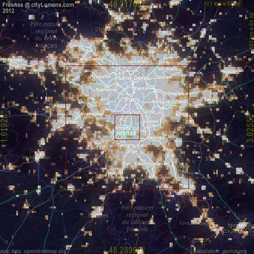
» Earth at Night: Flat Maps 2012, 2016