Antony night lights from space
Night Light of Antony (Île-de-France) from space (France) Src. Average luminocity for 10x10km area is 95.9018% and for 50x50km: 70.968%.
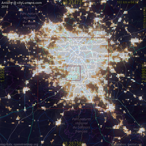
Analysis of Antony night lights 2016
Square area 10x10 km:
 49.55%
90-99
38.1%80-89
4.61%70-79
3.13%60-69
3.57%50-59
1.04%40-49
0%30-39
0%20-29
0%10-19
0%0-9
0%Square area 50x50 km:
33.69%90-99
17.72%80-89
4.98%70-79
4.82%60-69
5.4%50-59
4.25%40-49
5.69%30-39
5.1%20-29
5.24%10-19
4.17%0-9
8.93%Clear (daylight) street map image can be seen on geolist.org.
Map coordinates:
49° 12' 53" North, 1° 35' 36.8" East
48° 45' 11.8" North, 2° 17' 48" East
48° 17' 15.3" North, 2° 59' 59.3" East
Some cities around Antony sort by population:
• Massy
3.1 km =1.9 mi,  198°
198°
• Châtenay-Malabry
2.6 km =1.6 mi,  300°
300°
• Fresnes
1.9 km =1.2 mi,  81°
81°
• Sceaux
2.6 km =1.6 mi,  349°
349°
• Chevilly-Larue
4.1 km =2.5 mi,  72°
72°
• Bourg-la-Reine
3.2 km =2 mi,  28°
28°
• Verrières-le-Buisson
2.3 km =1.4 mi,  248°
248°
• Rungis
4.2 km =2.6 mi,  101°
101°
3037423 (p: 59,845)
Sources (retrieved 2019-11-25):
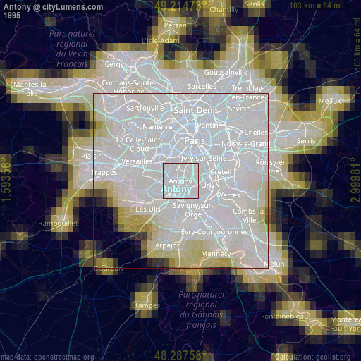
» NASA, Earths city lights 1995
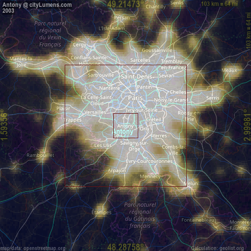
» NASA city lights 2003
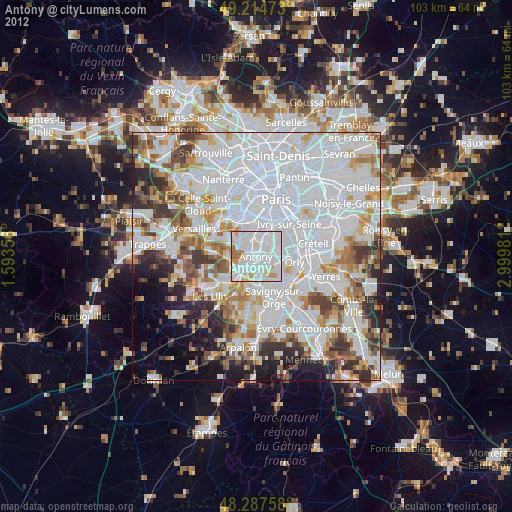
» Earth at Night: Flat Maps 2012, 2016