Darnétal night lights from space
Night Light of Darnétal (Normandy) from space (France) Src. Average luminocity for 10x10km area is 56.2647% and for 50x50km: 15.2543%.
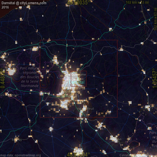
Analysis of Darnétal night lights 2016
Square area 10x10 km:
 21.43%
90-99
18.49%80-89
3.22%70-79
2.38%60-69
4.06%50-59
4.2%40-49
2.52%30-39
4.9%20-29
7.7%10-19
13.17%0-9
17.93%Square area 50x50 km:
3.52%90-99
2.92%80-89
0.91%70-79
1.35%60-69
1.46%50-59
1.81%40-49
2.17%30-39
2.76%20-29
4.52%10-19
8.52%0-9
70.05%Clear (daylight) street map image can be seen on geolist.org.
Map coordinates:
49° 54' 1.3" North, 0° 26' 54" East
49° 26' 43.2" North, 1° 9' 5.2" East
48° 59' 9.7" North, 1° 51' 16.5" East
Some cities around Darnétal sort by population:
• Rouen
3.8 km =2.4 mi,  266°
266°
• Sotteville-lès-Rouen
5.9 km =3.7 mi,  228°
228°
• Mont-Saint-Aignan
4.6 km =2.9 mi,  295°
295°
• Le Petit-Quevilly
7.4 km =4.6 mi,  241°
241°
• Bois-Guillaume
2.7 km =1.7 mi,  308°
308°
• Déville-lès-Rouen
7.7 km =4.8 mi,  290°
290°
• Bihorel
2.3 km =1.4 mi, 296°
• Le Mesnil-Esnard
3.6 km =2.2 mi,  187°
187°
3021717 (p: 9,064)
Sources (retrieved 2019-11-25):
» Earth at Night: Flat Maps 2012, 2016