Bihorel night lights from space
Night Light of Bihorel (Normandy) from space (France) Src. Average luminocity for 10x10km area is 68.8768% and for 50x50km: 15.4553%.
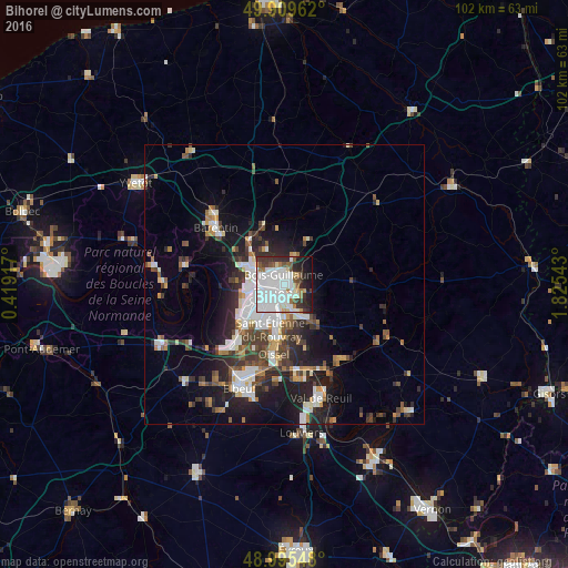
Analysis of Bihorel night lights 2016
Square area 10x10 km:
 31.37%
90-99
19.61%80-89
2.8%70-79
2.24%60-69
5.04%50-59
5.18%40-49
3.08%30-39
8.82%20-29
8.82%10-19
10.92%0-9
2.1%Square area 50x50 km:
3.54%90-99
2.93%80-89
0.93%70-79
1.39%60-69
1.53%50-59
1.84%40-49
2.2%30-39
2.81%20-29
4.57%10-19
8.33%0-9
69.92%Clear (daylight) street map image can be seen on geolist.org.
Map coordinates:
49° 54' 34.6" North, 0° 25' 9" East
49° 27' 16.8" North, 1° 7' 20.3" East
48° 59' 43.7" North, 1° 49' 31.5" East
Some cities around Bihorel sort by population:
• Rouen
2.1 km =1.3 mi,  232°
232°
• Sotteville-lès-Rouen
5.5 km =3.4 mi,  205°
205°
• Mont-Saint-Aignan
2.3 km =1.4 mi,  294°
294°
• Bois-Guillaume
0.6 km =0.4 mi,  359°
359°
• Déville-lès-Rouen
5.3 km =3.3 mi, 287°
• Darnétal
2.3 km =1.4 mi,  116°
116°
• Notre-Dame-de-Bondeville
6.1 km =3.8 mi,  301°
301°
• Le Mesnil-Esnard
4.9 km =3 mi,  160°
160°
3032662 (p: 8,589)
Sources (retrieved 2019-11-25):
» Earth at Night: Flat Maps 2012, 2016