Déville-lès-Rouen night lights from space
Night Light of Déville-lès-Rouen (Normandy) from space (France) Src. Average luminocity for 10x10km area is 65.2619% and for 50x50km: 15.4273%.
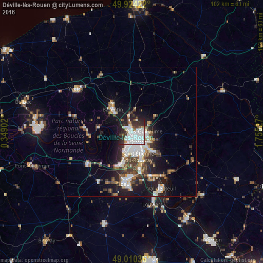
Analysis of Déville-lès-Rouen night lights 2016
Square area 10x10 km:
 29.69%
90-99
16.95%80-89
1.96%70-79
2.24%60-69
3.78%50-59
2.66%40-49
4.48%30-39
13.03%20-29
15.69%10-19
9.52%0-9
0%Square area 50x50 km:
3.54%90-99
2.96%80-89
1.08%70-79
1.36%60-69
1.49%50-59
1.78%40-49
2.16%30-39
2.79%20-29
4.34%10-19
7.87%0-9
70.63%Clear (daylight) street map image can be seen on geolist.org.
Map coordinates:
49° 55' 27.2" North, 0° 20' 56.5" East
49° 28' 9.9" North, 1° 3' 7.7" East
49° 0' 37.3" North, 1° 45' 19" East
Some cities around Déville-lès-Rouen sort by population:
• Rouen
4.5 km =2.8 mi,  130°
130°
• Mont-Saint-Aignan
3.1 km =1.9 mi,  103°
103°
• Le Petit-Quevilly
6.3 km =3.9 mi,  173°
173°
• Canteleu
3.8 km =2.4 mi,  211°
211°
• Bois-Guillaume
5.2 km =3.2 mi, 101°
• Maromme
2.3 km =1.4 mi,  298°
298°
• Bihorel
5.3 km =3.3 mi,  107°
107°
• Notre-Dame-de-Bondeville
1.6 km =1 mi,  354°
354°
3021484 (p: 10,548)
Sources (retrieved 2019-11-25):
» Earth at Night: Flat Maps 2012, 2016